Pangaea
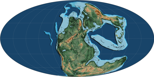
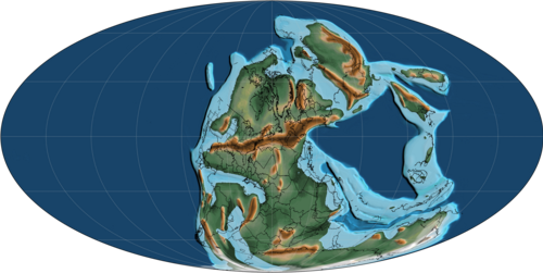
Map of Pangaea around 250 million years ago, at the beginning of the Triassic
Pangaea or Pangea (/pænˈdʒiːə/ pan-JEE-ə)[1] was a supercontinent that existed during the late Paleozoic and early Mesozoic eras.[2] It assembled from the earlier continental units of Gondwana, Euramerica and Siberia during the Carboniferous period approximately 335 million years ago, and began to break apart about 200 million years ago, at the end of the Triassic and beginning of the Jurassic.[3] Pangaea was C-shaped, with the bulk of its mass stretching between Earth's northern and southern polar regions and surrounded by the superocean Panthalassa and the Paleo-Tethys and subsequent Tethys Oceans. Pangaea is the most recent supercontinent to have existed and was the first to be reconstructed by geologists.
The name "Pangaea" is derived from Ancient Greek pan (πᾶν,) and Gaia or Gaea (Γαῖα, "Mother Earth, land").[4][9] The first to suggest that the continents were once joined and later separated may have been Abraham Ortelius in 1596.[10] The concept that the continents once formed a contiguous land mass was hypothesised, with corroborating evidence, by Alfred Wegener, the originator of the scientific theory of continental drift, in three 1912 academic journal articles written in German titled Die Entstehung der Kontinente (The Origin of Continents).[11] He expanded upon his hypothesis in his 1915 book of the same title, in which he postulated that, before breaking up and drifting to their present locations, all the continents had formed a single supercontinent that he called the Urkontinent.
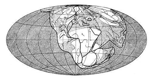
World map of Pangaea created by Alfred Wegener to illustrate his concept
Wegener used the name "Pangaea" once in the 1920 edition of his book, referring to the ancient supercontinent as "the Pangaea of the Carboniferous".[12] He used the Germanized form Pangäa, but the name entered German and English scientific literature (in 1922[13] and 1926, respectively) in the Latinized form Pangaea, especially during a symposium of the American Association of Petroleum Geologists in November 1926.[14]
Wegener originally proposed that the breakup of Pangaea was caused by centripetal forces from Earth's rotation acting on the high continents. However, this mechanism was easily shown to be physically implausible, which delayed acceptance of the Pangaea hypothesis.[15] Arthur Holmes proposed the more plausible mechanism of mantle convection,[16] which, together with evidence provided by the mapping of the ocean floor following the Second World War, led to the development and acceptance of the theory of plate tectonics. This theory provides the widely accepted explanation for the existence and breakup of Pangaea.[17]
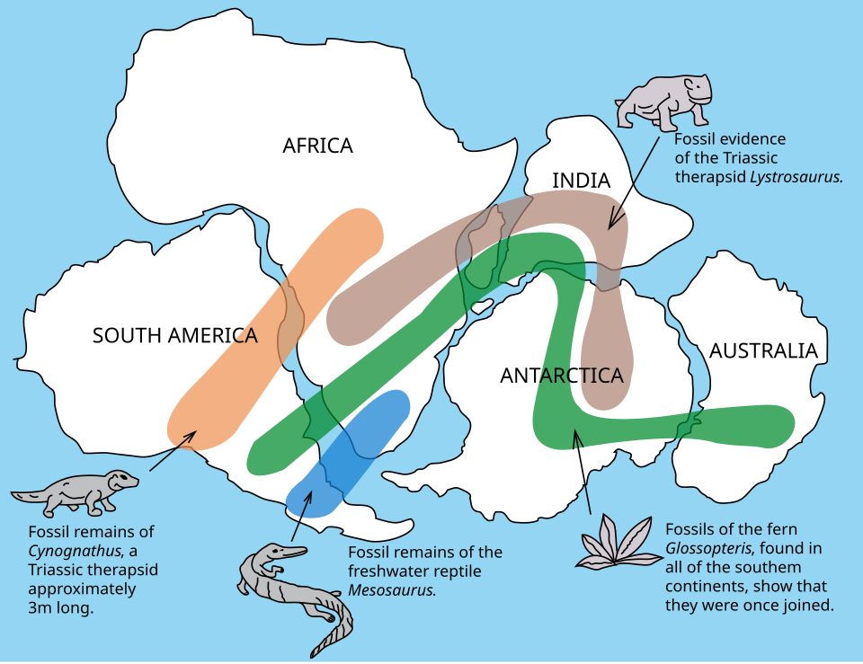
The distribution of fossils across the continents is one line of evidence pointing to the existence of Pangaea.
The geography of the continents bordering the Atlantic Ocean was the first evidence suggesting the existence of Pangaea. The seemingly close fit of the coastlines of North and South America with Europe and Africa was remarked on almost as soon as these coasts were charted. Careful reconstructions showed that the mismatch at the 500 fathoms (3,000 feet; 910 meters) contour was less than 130 km (81 mi), and it was argued that this was much too similar to be attributed to coincidence.[18]
Additional evidence for Pangaea is found in the geology of adjacent continents, including matching geological trends between the eastern coast of South America, the east coast of North America (namely the Appalachian Mountains), and the western coast of Africa. The polar ice cap of the Carboniferous covered the southern end of Pangaea. Glacial deposits, specifically till, of the same age and structure are found on many separate continents that would have been together in the continent of Pangaea.[19] The continuity of mountain chains provides further evidence, such as the Appalachian Mountains chain extending from the southeastern United States to the Scandinavian Caledonides of Europe;[20] these are now believed to have formed a single chain, the Central Pangean Mountains.
Fossil evidence for Pangaea includes the presence of similar and identical species on continents that are now great distances apart. For example, fossils of the therapsid Lystrosaurus have been found in South Africa, India and Antarctica, alongside members of the Glossopteris flora, whose distribution would have ranged from the polar circle to the equator if the continents had been in their present position; similarly, the freshwater reptile Mesosaurus has been found only in localized regions of the coasts of Brazil and West Africa.[21]
Geologists can also determine the movement of continental plates by examining the orientation of magnetic minerals in rocks. When rocks are formed, they take on the magnetic orientation of the Earth, showing which direction the poles lie relative to the rock; this determines latitudes and orientations (though not longitudes). Magnetic differences between samples of sedimentary and intrusive igneous rock whose age varies by millions of years is due to a combination of magnetic polar wander (with a cycle of a few thousand years) and the drifting of continents over millions of years. The polar wander component, which is identical for all contemporaneous samples, can be subtracted, leaving the portion that shows continental drift and can be used to help reconstruct earlier continental latitudes and orientations.[22]
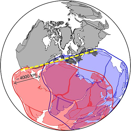
Map of two alternative proposals of the configuration of Pangaea at the Carboniferous-Permian boundary (300 million years ago), differing in their placement of Gondwana, the classic Wegnerian "Pangea A" (red) and "Pangea B" (blue). Yellow dashed line is the suggested location of the hypothetical megashear. Hatched lines represent the Variscan orogeny.
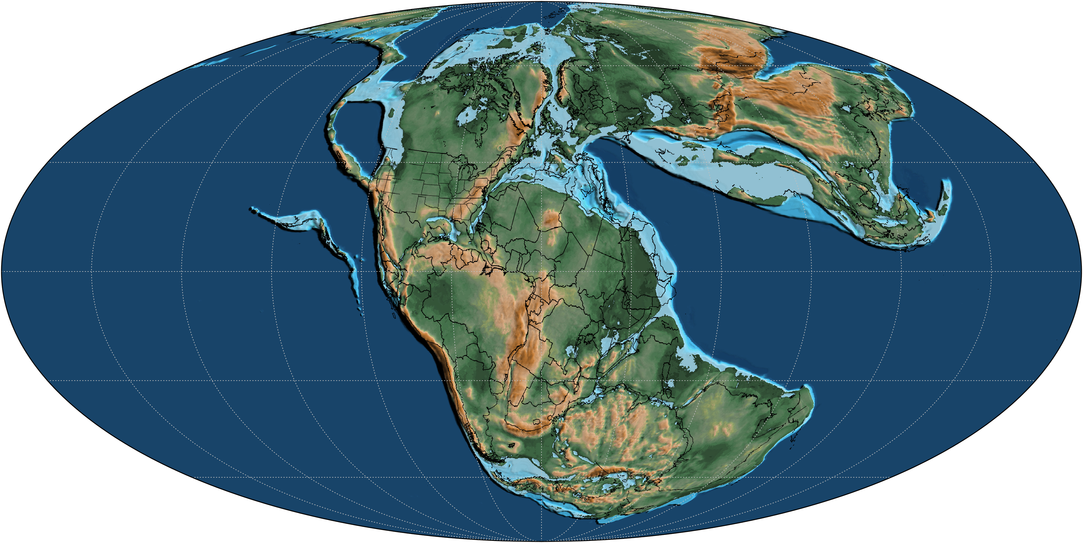
Central Pangean mountain range at the equator of Pangaea during the early Permian period (285 Mya).
:{Pangaea starting to disintegrate by the Early Jurassic (190 mya:{:{) period}:
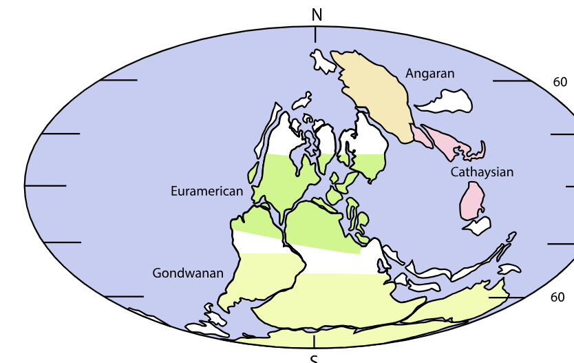
The four floristic provinces of the world at the Permian-Carboniferous boundary, 300 million years ago
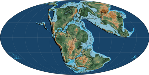
Map of Earth around 170 million years ago during the Early Jurassic, demonstrating opening of the North Atlantic
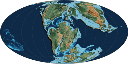
Map of Earth around 120 million years ago, during the Early Cretaceous
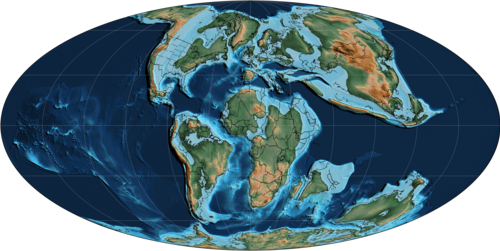
Map of Earth around 85 million years ago, during the Late Cretaceous
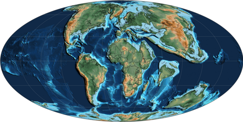
Map of Earth around 60 million years ago, during the Early Cenozoic (Paleocene)
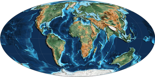
:{Map of Earth around 30 million years ago, during the mid-Cenozoic (Oligocen:{:{)e)}:
See PDF for balance of article downloaded from Wikipedia:
Saturday, January 17, 2026 11:54AM