DENTON KEEFER PROPERTY
The Denton-Keefer property is located in the southwest portion of the Timmins district. The property covers a section of volcanic and sedimentary rocks of the Abitibi greenstone belt, tightly bound by granodiorite on the north and tonalite on the south. The southern portion of the property includes a 6 kilometre segment of the Porcupine-Destor Fault, which in this location includes a panel of sedimentary rocks, including iron formation, possibly representing the Timiskaming assemblage. Along the eastern boundary of the property, the Porcupine-Destor Fault is offset 3 kilometres northward by a late fault.
The majority of the property is underlain by volcanic rocks of the Tisdale assemblage, including intermediate to felsic flows and fragmental rocks with minor tholeiitic basalt and komatiite flows, siliceous sedimentary rocks, and gabbro–diorite intrusions. Younger intrusive rocks include lamprophyre, syenite and felsic porphyry dikes, the latter locally containing base-metal (Cu-Mo) mineralization. Map patterns within the Tisdale assemblage are interpreted to define a map-scale syncline, the axial trace of which trends toward the west-southwest through the central portion of the property, cut by diabase dikes of the Paleoproterozoic Matachewan swarm.
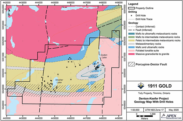
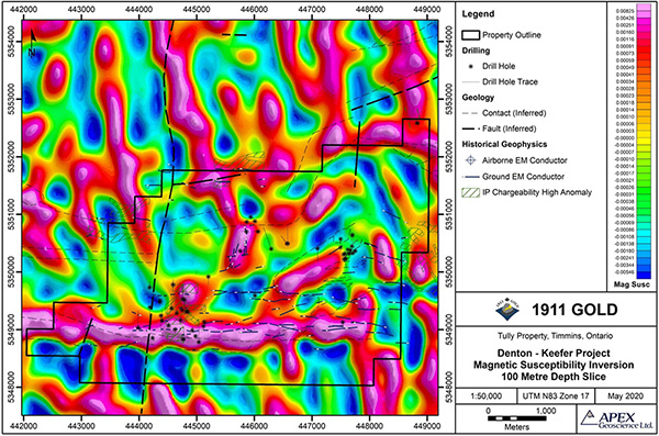
Owing to generally poor bedrock exposure on the property, only limited prospecting has taken place. Historical gold occurrences consist of quartz-carbonate veins and localized zones of sulphidation associated with brittle-ductile shears in the volcanic and sedimentary rocks of the Tisdale assemblage. A number of ground and airborne magnetic and electromagnetic surveys have been completed, as well as localized stripping, trenching, IP surveying and diamond drilling.
The drillhole database for Denton-Keefer includes 56 diamond drillholes, totaling 9,975 metres, which were completed in several campaigns between 1947 and 2010. The majority of this (36 drillholes, totaling 8,460 metres) was completed more recently (1998–2010), mostly near historical gold showings near Mosher Lake and Godon Lake, located in the southwest and northeast portions of the property, respectively. Grab samples from these showings have returned assay results up to 14.93 g/t gold, although drilling to date has generally returned sporadic low gold values.
The overall geological setting appears highly conducive to focusing of hydrothermal fluid-flow along the Porcupine-Destor Fault and through the narrow band of favourable Tisdale assemblage volcanic rocks; hence, the property is considered to have excellent potential for orogenic gold deposits.