FELIX PROJECT
The Felix Property is located in the Abitibi-Témiscarningue region, 86 kilometres NE of the town of Rouyn-Noranda and 37 kilometres north of the village of Taschereau. Most of the Property is located within the N.T.S. map sheet 32D15 while the seven southwestern claims are in NTS 32D16.
The Property consists of 69 mining claims with a total surface area of 3,259 hectares. The claims are 100% owned by Vanstar and no NSR (“Net Smelter Return) royalty is attached to the claims. They are located in Ranges 4, 5 and 6 in Ligneris Township. The Property is easily accessed from the town of Taschereau by an all-season road and a gravel road that leads to lac Authier.
Two periods of exploration occurred on the Property. In the late ‘50s, the discovery of an iron formation in the northern part of the Property attracted Atlas Chibougamau Mines Ltd for iron. Through the ‘80s, after the Vior gold discovery, a number of junior mining companies explored for gold and base metals.
Regional Geology
The sector under study is located in a pile of rocks of volcanosedimentary origin of Archean age. The lithologies are roughly ESE-WNW oriented, between the Ontario border to the south of Quévillon. There is a unit of volcanic rock in the north, another in the south and the central part is occupied by sedimentary rocks. Late intrusives occurred as batholiths, plutons or dykes.
Local Geology
The property is mainly underlain by the rocks of the Chicobi Group. The basin contains foliated turbiditic graphitic mudstone and sandstone, with minor banded magnetite-chert iron formation and hematite-jasper iron formation, and conglomerate. A large Algoma-type iron formation is present in the north part of the Property.
Previous Work
The Property has been explored in the past for Iron following the aeromagnetic survey from Geological Survey of Canada. In 1949, sampling and metallurgical testing was done to verify the grade and the metallurgical recovery of the iron. In 1957, 5 diamond drilled holes were drilled to verify the Iron formation.
After the publication of the Input Mark IV electromagnetic survey in 1972 by the Ministère de l’Énergie et des Ressources naturelles, mining companies started to explore for base metals. That led to the discovery of a gold occurrence in Hole 728-06-1 by Amax Exploration Inc. in the northeast part of the property. The mineralization is found in sedimentary rocks consisting of graphitic argillite with disseminated and seams of pyrite.
The compilation work made it possible to establish a compilation map bringing together the geological, geophysical and geochemical information available on the Felix property. The potential is assessed by considering all the public data.
A gold occurrence was found in Hole 728-06-1 in the sedimentary basin of the Chicobi Group. It is found within graphitic argillite mineralized with pyrite.
It is worth noting that only 9 samples were taken over a 70 m length of similar lithology and they all returned gold values:
- 1.4 g/t Au over 1.5m
- 1.8 g/t Au over 1.5m
- 1.5 g/t Au over 1.5m
- 0.9 g/t Au over 1.5m
- 0.9 g/t Au over 1.5m
- 1.4 g/t Au over 1.5m
- 1.5 g/t Au over 1.5m
- 1.8 g/t Au over 1.5m
- 1.4 g/t Au over 1.5m
The iron formation could also be an excellent target for gold. Gold associated with iron formation is usually associated with sulphide-facies iron formation. We can observe a discontinuity in the magnetic signature of the iron formation in the northeast part of the property. It possible that we are in presence of non-magnetic sulphides deposited as such at the time of its formation or by metamorphism associated with the deformation. A strong MEGATEM II conductor is present over the iron formation in the northeast part of the property. It might be caused by the presence of massive sulphides in the iron formation. Many electromagnetic conductors (VLF and HEM) and IP anomalies remained unexplained or untested. Some of them may be indicative of the presence of shear zones often associated with the presence of gold.
Recent work
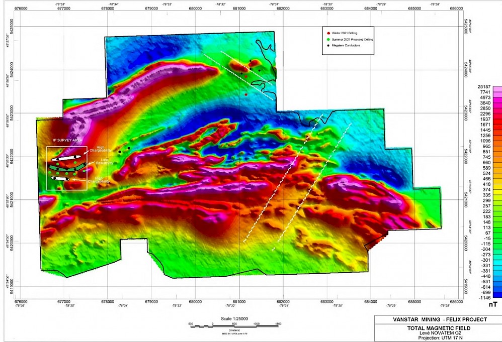
- An airborne magnetic survey carried out in June 2020 identified several faults and folds in what is believed to be iron formation that can act as structural traps for gold. Banded iron formation (BIF)-hosted gold deposits are structurally controlled stratabound deposits that represent one of the main gold exploration targets in the northern part of the Canadian Precambrian Shield.
- In February 2021, Vanstar completed a high-resolution airborn magnetic geophysical survey on its Felix Project located in the Quebec Abitibi Greenstone Belt. In combination with the survey that was completed in June of 2020, the new survey was flown over 37.2 km2 with 25 meters spacing, providing much higher resolution and granularity of key structures on the property than was seen in previous magnetic surveys.
Additional details: Vanstar Completes High Resolution Magnetic Survey on Felix and Increases Drill Program
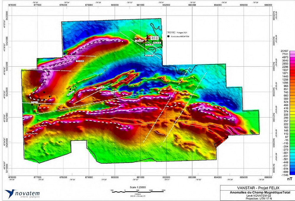
- In June 2021 -Vanstar concluded an Induced Polarity (“IP”) survey on the Felix property. The IP survey focused on a western portion of the property underlain by a folded banded iron formation and preliminary results identified a number of chargeability anomalies that are consistent with previously reported MEGATEM conductors.
Additional details: Vanstar Announces Drilling Update on Felix