Behaim M
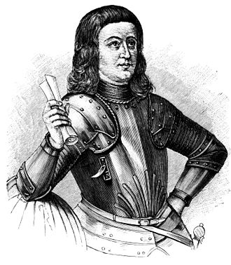
ACHIEVEMENT(S): Nuremberg Terrestrial Globe (earliest surviving geographic globe)
NICKNAME/ALIAS:
DATE AND PLACE OF BIRTH: October 6, 1459, Nuremberg, Germany
DATE/PLACE OF DEATH/AGE AT DEATH: July 29, 1507, Lisbon, Portugal. Age 47.
DISCIPLINE: Navigator/geographer
FIELD: Cartography
LANGUAGE: German/Portuguese
PARENTS: Martin Behaim; Agnes Schopper
SIBLINGS: Stephan; Michael; Wolfrath; Ursula; Elsbeth; Magdalena
SPOUSE: Joanna van Huerter de Moerbeke
CHILDREN: Martin
EDUCATION: Schools in Nuremberg
MAJOR WORK: Nuremberg Terrestrial Globe
LIFE AND TIMES:
After his father died when he was 15, Behaim came under the joint care of his paternal uncle, Leonhard Behaim, and Bartels (Bartholomew) von Eyb, a family friend, who insisted he continue his apprenticeship in commerce. Behaim became acquainted with the great astronomer Regiomontanus*, who was living in Nuremberg. It was probably through Regiomontanus and his book "Ephemerides", published 1475-1506, that the young Behaim learned to use astronomical instruments.
After his apprenticeship ended when he was 17, his guardians sent him abroad to improve his technical and commercial knowledge. He was first placed with Jorius van Dorpp, a cloth merchant in Mechlin, Netherlands, but stayed less than a year.
At 19, he moved to Antwerp, the country’s most important seaport, where he remained -- likely as a cloth merchant -- until he was 24. In 1484, at 25, Behaim traveled to Lisbon as a merchant, to take advantage of the strong commercial relations between Portugal and Flanders.
Because of his acquaintance with Regiomontanus, Behaim was asked by Portugal's King John II to advise a Council of Mathematicians on setting up simple rules for calculating latitude at sea from midday altitudes of the sun, since the Pole Star, the traditional reference point, was unusable once navigators had crossed the equator. The Council included Jose Vicinho, who in 1485 arranged a sea expedition to find the answers first-hand, following the Guinea coast of Africa, during which Behaim, Vicinho and company set about calculating latitudes and times by observing midday altitudes of the sun, moon and stars.
After the expedition, the Council advised that ships sailing south of the Equator should observe midday altitudes of the sun for finding latitude with both quadrant and seaman's astrolabe. Soon after, the Council ordered that the "Almanach perpetuum", written some 10 years earlier by Abraham Zacuto, a teacher of Vicinho, be printed to facilitate the calculation of the observations made. These reforms led to the adoption of graduated sailing charts, which to that time were unknown in Portugal.
Behaim was knighted in Portugal in 1485, and in 1486, married Joanna van Huerter de Moerbeke, the daughter of the leader of a large Flemish colony on the island of Fayal. The marriage brought him court and society connections, but it is unknown whether Behaim then continued as a merchant, or gave up commerce, took up residence in Fayal, and assisted his father-in-law in the management of his large estate.
In the spring of 1490, when he was 31, Behaim left Fayal for Nuremberg, to look after his own family estate after his mother's death. In 1491, he met Nuremberg town council member George Holzschuher, a world traveler, who suggested that Behaim design a globe upon which the recent Portuguese discoveries could be marked. For two years, Behaim worked in Nuremberg on what was to become his famous "terrestrial globe", the first of its kind.
Behaim's globe was 51 centimeters in diameter, covered with parchment with many types of figures (111 miniatures, 48 banners, and 15 coats of arms), and many inscriptions that explained the geography of 1,100 localities all over the world. Basically, the globe constituted an adaptation of a nautical chart onto a sphere.
Behaim did the compilation of the map, but admitted that for the rest of it, he drew upon Ptolemy's* "Cosmography'", the work of Isidore of Seville, the travels of Marco Polo* and Sir John Mandeville, and the recent explorations carried out by the Order of King John of Portugal.
Behaim's most important source of information was the library of Regiomontanus. Despite Portuguese discoveries in every part of the world, the globe was surprisingly inaccurate, especially as regarded the west coast of Africa.
After Behaim returned to Portugal in 1493, he was almost immediately sent off to Flanders on a mission for King John II. En route, he was taken prisoner by the English and imprisoned for three months, but finally was released and arrived in Antwerp in March, 1494. The nature of his mission is not known. After his return to Portugal in late 1494, Behaim took up permanent residence on Fayal, where he lived with his wife and son, and continued occasionally to trade as a merchant.
ASSESSMENT: Greatly advanced the art of navigation with his "Terrestrial Globe", which alone makes him one of the greatest geographers of the Renaissance.
EXTRA CONNECTIONS: His work related to that of ben Gershom*
ONELINER: Martin Behaim, who made the first terrestrial globe
BIBLIOGRAPHY:
EB, DSB
Ravenstein, E.G., Martin Behaim: His Life and his Globe, London: George Philip & Son, 1908.