BIRCH UCHI PROPERTIES
The discovery of gold at Red Lake in 1926 precipitated approximately 10 years of extensive prospecting activity in the Birch-Uchi greenstone belt, which led to the discovery of numerous showings and several mines. Exploration activity has continued intermittently at moderate to high levels over the past 100 years. Despite the volume of work conducted, the advancement of exploration technologies and mineralization models continue to yield exciting new discoveries in the belt, such as Prosper Gold’s Golden Corridor, which lies 25 km west of the Satterly Lake property.
Satterly Lake
The Satterly Lake property is located approximately 90 km east of Red Lake. It comprises 8 contiguous claims (3,049 ha) underlain by felsic metavolcanic and coarse clastic metasedimentary rocks of the Birch-Uchi greenstone belt. The highly prospective Grace Lake Deformation Zone transects the southwest portion of the property. This D2 shear zone is interpreted as a splay off the northeast trending Swain Lake Deformation Zone, both of which host numerous gold occurrences to the west of the property.
The Satterly Lake property is relatively unexplored, but several mineral occurrences documented on adjacent properties have potential to extend along strike onto the property. Located only 1.5 km off the western boundary, the Sol D’Or Mine produced 256 ounces of gold and 33 ounces of silver (Ag) between 1933 and 1936 from 232 tonnes of ore grading 19.2 grams per tonne (g/t) Au (458 tons at 0.56 ounces per ton (opt) Au). Ore zones were described as east-trending mineralized quartz veins in felsic tuffs. According to historical government records, the estimated reserves on the property in 1936 were 7,770 tonnes at 19.5 g/t Au (8,565 tons @ 0.57 opt Au) (OGS Open File Report 5835, 1989) – the Qualified Person has not done sufficient work to classify this historical estimate as a current resource. The company is not treating the historical estimate as a current resource.
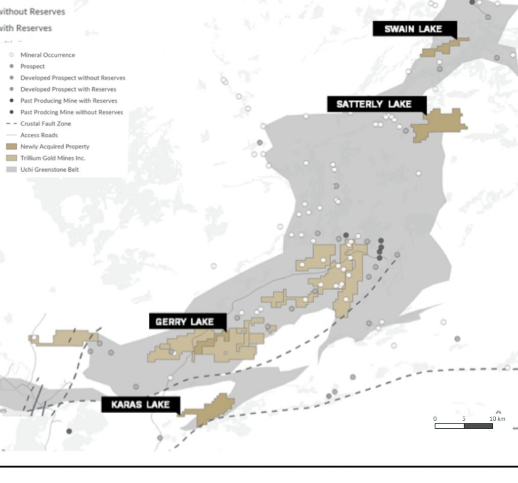
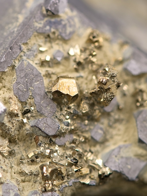
The Hanson gold occurrence, discovered in 1947, is located 1 km north of the property. The best historical results reported were 6.2 g/t Au over a 1.5m drill intercept in mineralized diorite and 18.5 g/t Au from a grab sample. Just 500m further north, the Loydex copper-zinc occurrence was discovered by Noranda in 1985. Diamond drilling intersected multiple zones in a quartz-diorite intrusive with alteration and indicator mineralization commonly associated with gold including narrow chlorite and carbonate altered shear zones with up to 2% sulphide minerals (pyrrhotite, pyrite), silicified zones with 10% disseminated pyrite, 2m wide zones containing 20-30% quartz-carbonate veinlets having 5-10% pyrite, pyrrhotite, magnetite, and tourmaline along the margins; arsenopyrite veinlets, and an 8m wide zone with strong sericitization. No assay results were reported from this drilling. To the east of the Satterly Lake property lies Falcon Gold’s Springpole West property, where in 1979 Sherritt Gordon Mines Ltd. intersected 19.40 g/t Au over 30cm in a diamond drill hole within a gold-bearing, silicified, property-wide fault zone hosted in a quartz vein-stockwork system. Massive sulphide pods were also encountered along the fault zone with significant zinc, silver, and gold values.
Swain Lake
The 46 claim 1,832 hectare Swain Lake property is located 8 km northwest of First Mining’s Springpole Lake property, which is reported as one of the largest undeveloped gold projects in Canada. First Mining’s Preliminary Economic Assessment (“PEA”), completed in November 2019, reported an Indicated Resource of 4,670,000 ounces of Au and 24,190,000 ounces of Ag from 139.1 Mt of ore grading 1.04 g/t Au and 5.4 g/t Ag, as well as an Inferred Resource of 11.4 million tonnes averaging 0.63 g/t Au and 3.1 g/t Ag, containing 230,000 ounces of Au and 1,120,000 ounces of Ag.
The Swain Lake property encompasses a nine-kilometre stretch of the Swain Lake Deformation Zone (SLDF), over a gentle flexure point where the strike changes from a northeast trend to more easterly. Numerous gold occurrences are documented along the strike of this regional-scale structure.
To the north of the SLDF, the property is underlain by mafic-intermediate metavolcanic rocks and gabbro. To the south lie felsic metavolcanic rocks that strike northeast and dip subvertically. Proximal to the SLDF, intense strain and deformation produce a gossaneous quartz-sericite-ankerite-pyrite schist with associated fracture zones commonly filled with quartz-ankerite-(tourmaline) veining and trace to 5% disseminated pyrite.
Mineral exploration conducted on the property in the 1970s and 1990s included mapping, geochemical sampling, trenching and 2 diamond drill holes totalling approximately 400m in depth. Although no economic mineralization was identified from the earlier programs, structural, alteration and mineralogical indicators suggest further investigation is warranted.
Other notable mineral deposits/occurrences within a six-kilometre radius of the Swain Lake property include:
The Argosy Mine: milled 250,900 Mt of ore grading 12.63 g/t to produce 101,875 ounces of gold between 1934 to 1952 Richardson Lake: reported to have produced 1126 ounces oz Au and 102 oz Ag from 577 tonnes grading 60.7 g/t Au. An unclassified historical resource of 635,000 tonnes grading 6.86 g/t was calculated by Golden Terrace Resources Corp and published in the Northern Miner; June 20, 1988 The MacIntyre Mine: reported to have produced 23 ounces of gold in 1934-35 from gold-bearing quartz-tourmaline veins accompanied by arsenopyrite, pyrite and chalcopyrite along shears in mafic to intermediate volcanic rocks First Mining’s Horseshoe Island prospect: a historical unclassified resource of 810,500 t grading 4.8 g/t Au (OGS MDI record 52N08NW00020)