KITIMAT COPPER GOLD PROJECT JV
Highlights
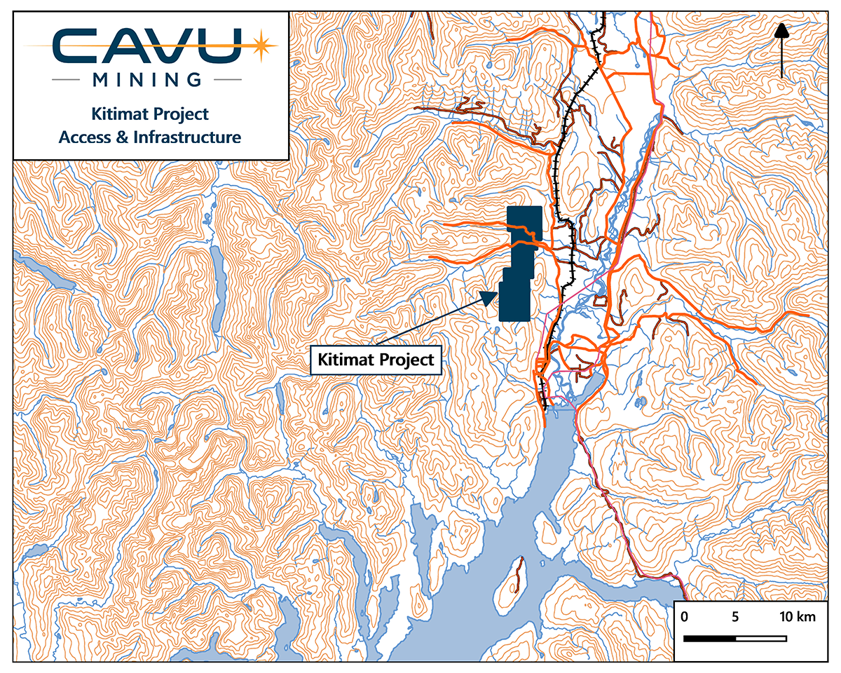
- 13 km by road from the port town of Kitimat BC
- Road accessible
- 38 Diamond drill holes, over 6,000m drilled
- Historical drilling intercept: 105m grading 0.60% Cu and 1.15 g/t Au1
Overview
The Kitimat Project is an exploration stage VMS & porphyry copper-gold prospect that is vehicle accessible and close to infrastructure. The 3,070 hectare property is situated 13 km by road from the port town of Kitimat where a deep-water port and hydroelectric power are located. The project is under option from Pacific Empire Minerals Corp. (“PEMC”).
The property is underlain by Triassic to Jurassic Stikine volcanic rocks which have been juxtaposed against Late Cretaceous to Paleogene granodiorites and diorites of the Coast Plutonic Complex to the west. These units have been intruded by felsic, mafic and feldspar porphyry dikes of Late Cretaceous to Eocene age. There are two main target areas on the property, the Jeanette and the Bowbyes areas. The Jeanette has been interpreted as a VMS feeder zone by government geologist, and as low-sulfidation epithermal mineralization by exploration geologists. The most recent work by PEMC has highlighted porphyry copper potential adjacent to the Jeannette area.
The Bowbyes target area consists of quartz-sericite-pyrite alteration over intermediate volcanic rocks, with a coincident copper and molybdenum soil anomaly.

Jeanette target area
Historical drilling at the Jeanette target area intersected copper-gold-silver mineralization associated with quartz-sericite-pyrite alteration that locally overprints a propylitic assemblage. Localized potassic alteration is also present, though not necessarily associated with mineralized zones.
Mineralization encountered to date at the Jeanette area consists of chalcopyrite-pyrite as veins, quartz vein-fill and as disseminations within silicified zones. Copper and gold values are intimately associated with historical drill intercepts highlighted by 105 m grading 0.60% Cu and 1.15 g/t Au (DDH J-2010-07, Decade Resources Ltd.). Although chalcopyrite content locally is up to 15%, the predominance of pyrite suggests that a higher temperature chalcopyrite dominant sulphide assemblage is yet to be discovered.
During 2017, PEMC completed an exploration program consisting of a soil and bark geochemical survey over the Jeanette target area with four, approximately one kilometre long, lines spaced 100 metres apart. The results of this survey confirmed the presence of anomalous copper in soils and further defined the historical copper-in-soil anomaly outlined by previous operators. The copper soil anomaly at the Jeanette area measures approximately 200 m x 500 m with the majority of the anomaly lying upslope and to the west of the 2010 diamond drilling. The overburden to the east thickens rapidly, which reduces the effectiveness of soil sampling as an exploration tool.
Historical drilling has been focused on high-grade mineralization in the Jeannette zone. However, the theory that this is a feeder zone or distal effect of a larger mineralized system has never been tested.
Bowbyes target area
2017 Prospecting at the Bowbyes area confirmed confirmed the presence of widespread alteration associated with anomalous soil geochemistry. Quartz-sericite-pyrite altered intermediate volcanic rocks occur over an area of 2,000 x 800 m. The Bowbyes area is partly overlain by a copper and molybdenum in soil anomaly.
Despite the alteration and copper-molybdenum soil anomaly the Bowbyes zone has never been drilled. Drilling has instead focused on several high-grade but small skarn showings at the southern edge of the property.
Historic drilling
Decade resources drilled the Jeannette showing in 2010. They focused mostly on the best mineralized sections and drilled parallel to a set of intrusions. The drill results highlight the tenor of mineralization and length of the mineralized interval. The true dip of the mineralized intersects remained unknown.
 4% Cu, 24.1 g/t Au, 13 g/t Ag over 1.68 m in silicified and sericitized volcanic rocks (DDHJ-2010-7 from 77.4-79.1m)
| FROM (M) | TO (M) | INTERVAL (M) | CU (%) | AU (G/T) | |
|---|---|---|---|---|---|
| J-2010-1 | 18.75 | 112.80 | 94.06 | 0.52 | 1.12 |
| J-2010-2 | 21.49 | 113.11 | 91.6 | 0.51 | 0.93 |
| J-2010-7 | 21.34 | 126.22 | 105.85 | 0.60 | 1.15 |
Pacific Empire Minerals Corp., tried to replicate the drill results by Decade resources. They attempted to twin the best hole of Decade Resources but placed the drill collar several meters to the south. Due to the offset, their hole intersected a dyke along strike. Several other RC holes meant to test deeper targets ended up stuck in overburden.
| FROM (M) | TO (M) | INTERVAL (M) | CU (%) | AU (G/T) | |
|---|---|---|---|---|---|
| RC18KIT001 | 15.2 | 18.2 | 3.1 | 0.53 | 0.19 |
| RC18KIT002 | 56.4 | 62.5 | 6.1 | 0.19 | 0.27 |
The Kitimat project contains several high-quality targets. The Jeannette target is a porphyry target with associated soil and magnetic anomaly. The southern Bowbyes target is a large soil copper and molybdenum anomaly overlying altered volcanic rocks. Both targets will be further defined through geophysical surveys and then drill-tested in a 2-phase exploration program