ZGOUNDER SILVER MINE
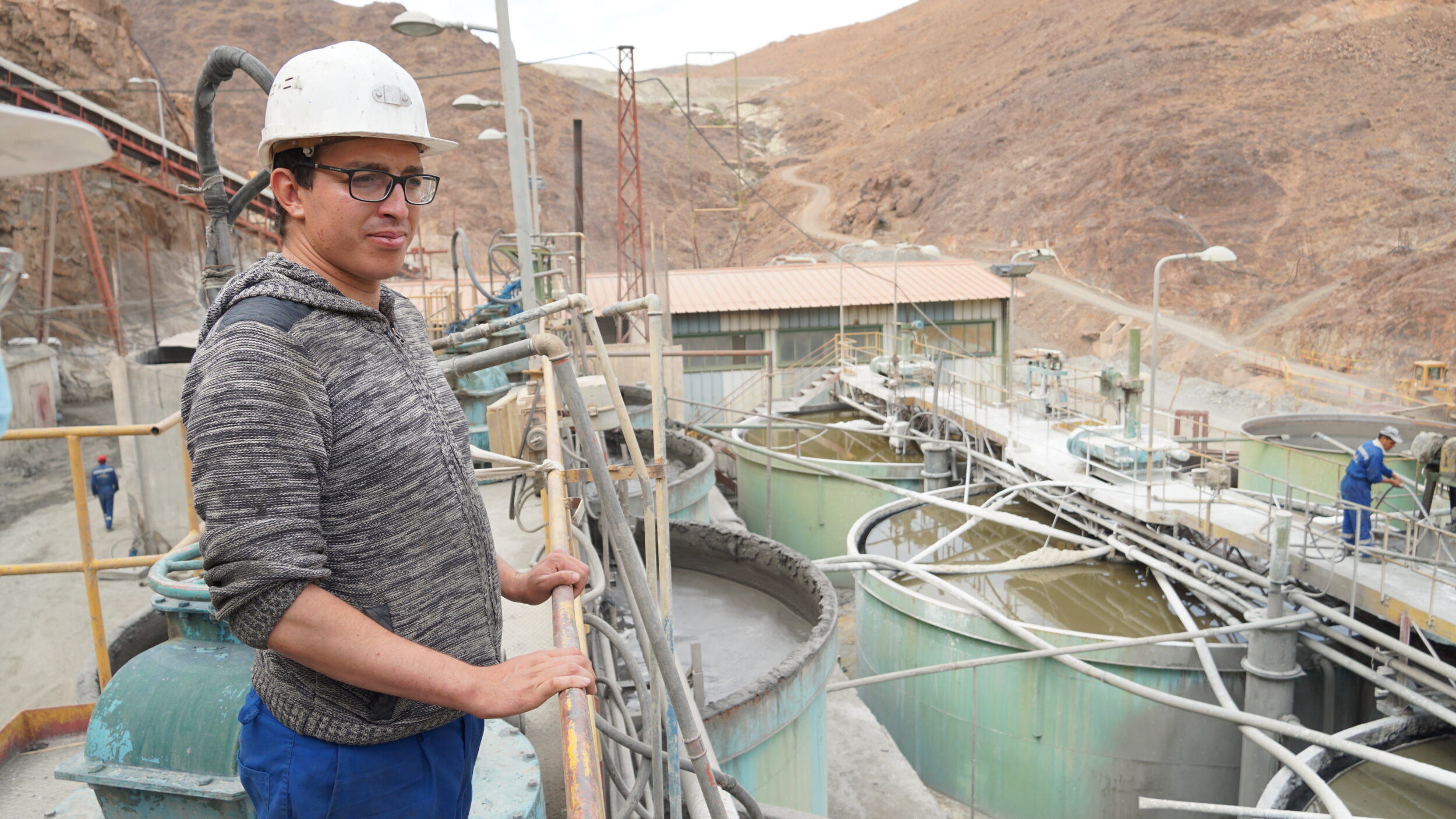
Located in the central Anti-Atlas mountains, Zgounder is the second most-important silver mine in Morocco after the Imiter Mine. Commercial production was reached in January 2019. Following a change of management in May 2020, a 12-month operations turnaround plan was implemented with the aim of reaching nameplace capacity of 700 tonnes per day.
Highlights
- 2020 silver production: 726,319 oz
- 2021 silver production guidance: 1.2 million oz
- Type of mine: underground
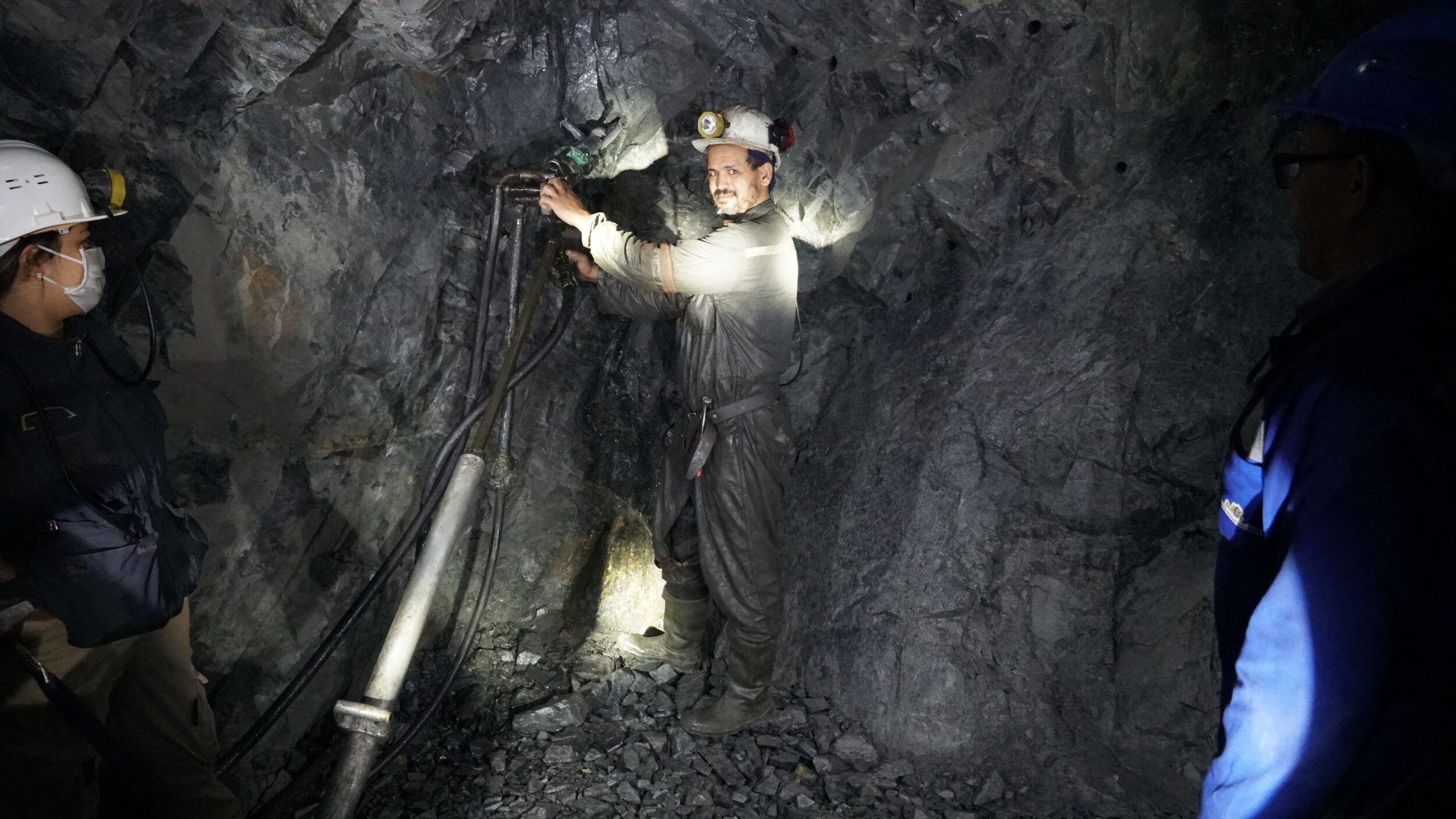
- Mining method: long-hole
- Processing method: flotation (500 tpd) – cyanidation (200 tpd)
- Ownership: 85%-15% joint venture between Aya and ONHYM (the Office National des Hydrocarbures et des Mines) of the Kingdom of Morocco
- Measured & indicated mineral resources: 4,893,000t at 282 g/t Ag for 44,410,000 oz (March 1, 2021)
- Inferred mineral resources: 59,000t at 209 g/t Ag for 395,000 oz (March 1, 2021)
- Feasibility study underway for expansion to 2,700 tpd
- Two resources estimates planned: Q1 2021 and Q4 2021, as part of the expansion feasibility study
History
900 - 1200
First explored and mined
1982 - 1990
SOMIL-owned UG mine at 75,000t/yr
1990 - 1997
Exploration by the BRPM
2009
PFS to re-open Zgounder Mine
2012
Acquisition of Zgounder
2013
Creation of Zgounder Millennium Silver Mining
2014
First silver pour:
200-tpd mill capacity
2015 - 2017
4,820m of T28 drilling &
13,140m of DD surface drilling
2018
PEA & NI 43-101
2019
Flotation plant:
commercial production
2020
Flowsheet reconfiguration
2021 Feasibility Study
A feasibility study has been launched to investigate the feasibility of expanding Zgounder Mine throughput from 700 tpd to 2,700 tpd or production of between 4-5 million Ag oz per year. Completion of the feasibility study, which is being carried out in partnership with DRA Met-Chem, is expected by year-end 2021.
#### Technical reports
**Technical Report and Updated Mineral Resource Estimate – April 30, 2021**
**Preliminary Economic Assessment – Technical Report March 16, 2018**
**Preliminary Economic Assessment (March 2014)**
Location
The mine is located approximately 260 kilometres east of Agadir (pop. 575,320), within the Proterozoic Siroua Massif of the Anti-Atlas range.
Access
The Zgounder Mine is accessible from Agadir on well-maintained paved highways (N10 and P1706) that run east for 205 kilometres to Taliouine in the Taroudant province. The bulk of the remaining 61 kilometres to the mine are traveled on a well-paved road to the village of Askaoun. The last five-kilometre stretch to the mine is on a dirt road that could be easily be upgraded.
Surface area
The mining permit covers 16 km², and the 7 exploration permits cover 96 km².
Operating Highlights
| 2020 | 2019 | 2018 | |
|---|---|---|---|
| Ore processed (tons) | 128,923 | 100,667 | 39,763 |
| Average grade (g/t Ag) | 255 | 217.6 | 278.5 |
| Silver ingots produced (oz) | 439,448 | 286,294 | 258,469 |
| Silver concentrate produced (oz) | 286,871 | 166,122 | – |
| Total silver produced (oz) | 726,319 | 452,416 | 258,469 |
Geological and Structural Framework
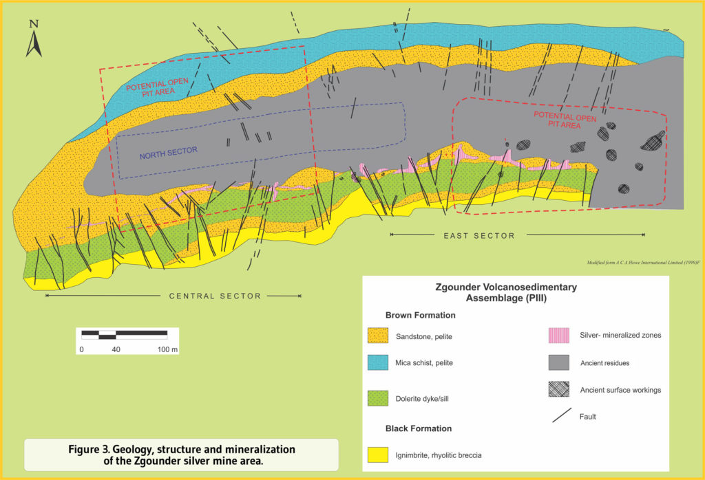
The Zgounder shale-sandstone strikes N90°E and dips strongly to the south, forming the southern flank of an anticline generated by NS-compression. There are four types of faulting and fracturing present at Zgounder:
1) an EW-oriented system corresponding to the opening and filling of fractures with argillaceous material and to subvertical fractures; 2) a NS-oriented system with a northward reject;
3) a NNE-NNW-oriented system dipping 60 to 75°E; and
4) a subhorizontal system oriented NNE-SSW that generated a staircase collapse of the Brown Formation toward the north.
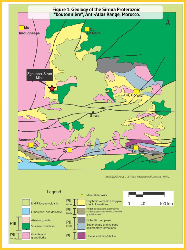
The Zgounder silver deposit sits within the Proterozoic Siroua “boutonnière” or massif that occupies a transitional position between the northern mobile Panafrican belt and the southern Eburnean domain comprised in the stable West-African Craton. The Siroua massif is composed of geological assemblages belonging to the Precambrian I, II and III, each separated by major discontinuities. The oldest rocks of the Siroua Massif (P1) consist of gneisses and amphibolites unconformably overlain by ophiolitic complexes, volcanosedimentary units, alternating schist-sandstones and limestones, quartzites and turbidites (PII). The Zgounder deposit occurs in the PIII assemblage (Late Neoproterozoic) characterized by a felsic calc-alkaline/alkaline volcanic activity corresponding to the initiation of rifting process announcing the Infracambrian–Cambrian transgression.
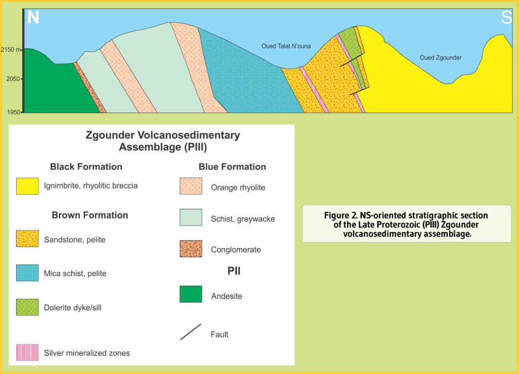
The Zgounder volcanosedimentary assemblage forms a large EW-oriented monoclinal structure with a general southerly tilt. To the north, the assemblage rests on an andesitic basement, to the west it is intruded by the Askaoun granodioritic massif (PIII), whereas to the east it is overlain by volcanosedimentary rocks of the Ouerzazate series (PII) and Neogene phonolites.
The Zgounder series is divided into three units, which are in stratigraphic order:
1) The Blue Formation (300-400m) consisting of sandstone, greywacke and shale with layers of tuff and quartz keratophyre followed by an orange rhyolitic unit;
2) The Brown Formation composed of 350 to 450m of micaceous schistose sandstone overlain by a 45m thick dolerite sill/dyke; and
3), The 900m-thick Black Formation containing at its base a felsic volcanic complex (ignimbrite, rhyolitic breccia, divitrivied rhyolite) and forming the hanging rock of the Ag-mineralization over the Brown Formation. To the south, the Black Formation culminates in sandstone, greywacke and conglomerate.
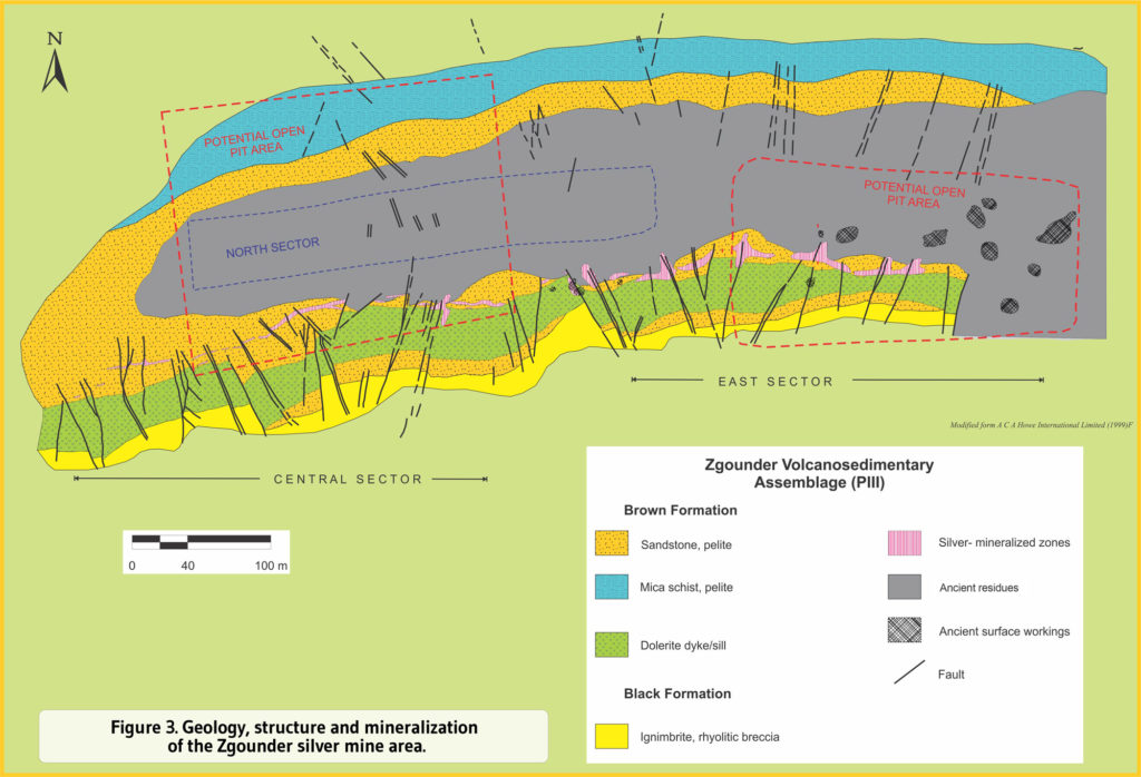
The Zgounder shale-sandstone strikes N90°E and dips strongly to the south, forming the southern flank of an anticline generated by NS-compression. There are four types of faulting and fracturing present at Zgounder:
1) an EW-oriented system corresponding to the opening and filling of fractures with argillaceous material and to subvertical fractures; 2) a NS-oriented system with a northward reject;
3) a NNE-NNW-oriented system dipping 60 to 75°E; and
4) a subhorizontal system oriented NNE-SSW that generated a staircase collapse of the Brown Formation toward the north.
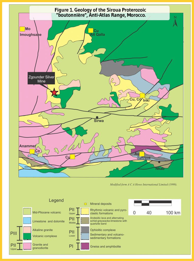
The Zgounder silver deposit sits within the Proterozoic Siroua “boutonnière” or massif that occupies a transitional position between the northern mobile Panafrican belt and the southern Eburnean domain comprised in the stable West-African Craton. The Siroua massif is composed of geological assemblages belonging to the Precambrian I, II and III, each separated by major discontinuities. The oldest rocks of the Siroua Massif (P1) consist of gneisses and amphibolites unconformably overlain by ophiolitic complexes, volcanosedimentary units, alternating schist-sandstones and limestones, quartzites and turbidites (PII). The Zgounder deposit occurs in the PIII assemblage (Late Neoproterozoic) characterized by a felsic calc-alkaline/alkaline volcanic activity corresponding to the initiation of rifting process announcing the Infracambrian–Cambrian transgression.
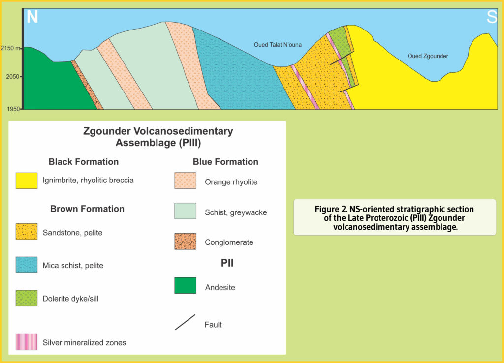
The Zgounder volcanosedimentary assemblage forms a large EW-oriented monoclinal structure with a general southerly tilt. To the north, the assemblage rests on an andesitic basement, to the west it is intruded by the Askaoun granodioritic massif (PIII), whereas to the east it is overlain by volcanosedimentary rocks of the Ouerzazate series (PII) and Neogene phonolites.
The Zgounder series is divided into three units, which are in stratigraphic order:
1) The Blue Formation (300-400m) consisting of sandstone, greywacke and shale with layers of tuff and quartz keratophyre followed by an orange rhyolitic unit;
2) The Brown Formation composed of 350 to 450m of micaceous schistose sandstone overlain by a 45m thick dolerite sill/dyke; and
3), The 900m-thick Black Formation containing at its base a felsic volcanic complex (ignimbrite, rhyolitic breccia, divitrivied rhyolite) and forming the hanging rock of the Ag-mineralization over the Brown Formation. To the south, the Black Formation culminates in sandstone, greywacke and conglomerate.
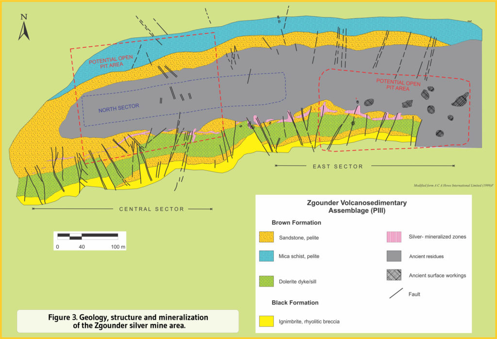
The Zgounder shale-sandstone strikes N90°E and dips strongly to the south, forming the southern flank of an anticline generated by NS-compression. There are four types of faulting and fracturing present at Zgounder:
1) an EW-oriented system corresponding to the opening and filling of fractures with argillaceous material and to subvertical fractures; 2) a NS-oriented system with a northward reject;
3) a NNE-NNW-oriented system dipping 60 to 75°E; and
4) a subhorizontal system oriented NNE-SSW that generated a staircase collapse of the Brown Formation toward the north.


Mineralization
The silver mineralization occurs in three, often superposed, genotypes:
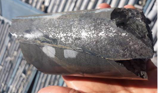
1) Mm-thick beds of well-crystallized, finely disseminated pyrite associated with quartz and other sulphides found in chloritized and tuffaceous pelitic layers of the Brown Formation with low silver grades (5 to 25 g/t Ag) (Figure 5);
2) Native silver veinlets associated with proustite (Ag₃AsS₃), argentite (Ag₂S) and filling micro-fractures discordant with the stratitification and suggesting a stockwork-type mineralization; and
3) Native silver dissemination with sulphide veinlets (sphalerite, galena, argentite and cinabar) in brecciated sandstone-shale layers and spotted by nodules and flakes of chlorite and/or carbonate microlithes.
The paragenetic sequence shows two successive stages: an early Fe-As stage (silver-bearing pyrite and arsenopyrite), followed by an Ag-bearing polymetallic (Zn, Pb, Cu, Hg; sphalerite and chalcopyrite) stage. Native silver is by far the most common silver mineral and forms an amalgam with Hg. Tension gashes originally trapped the silver mineralization within a NNE-oriented shear zone affecting the Brown Formation shale-sandstone beds containing anomalous Ag values. These were then transposed by EW-oriented structures forming isolated Ag-mineralized lenses and fissures.
Exploration
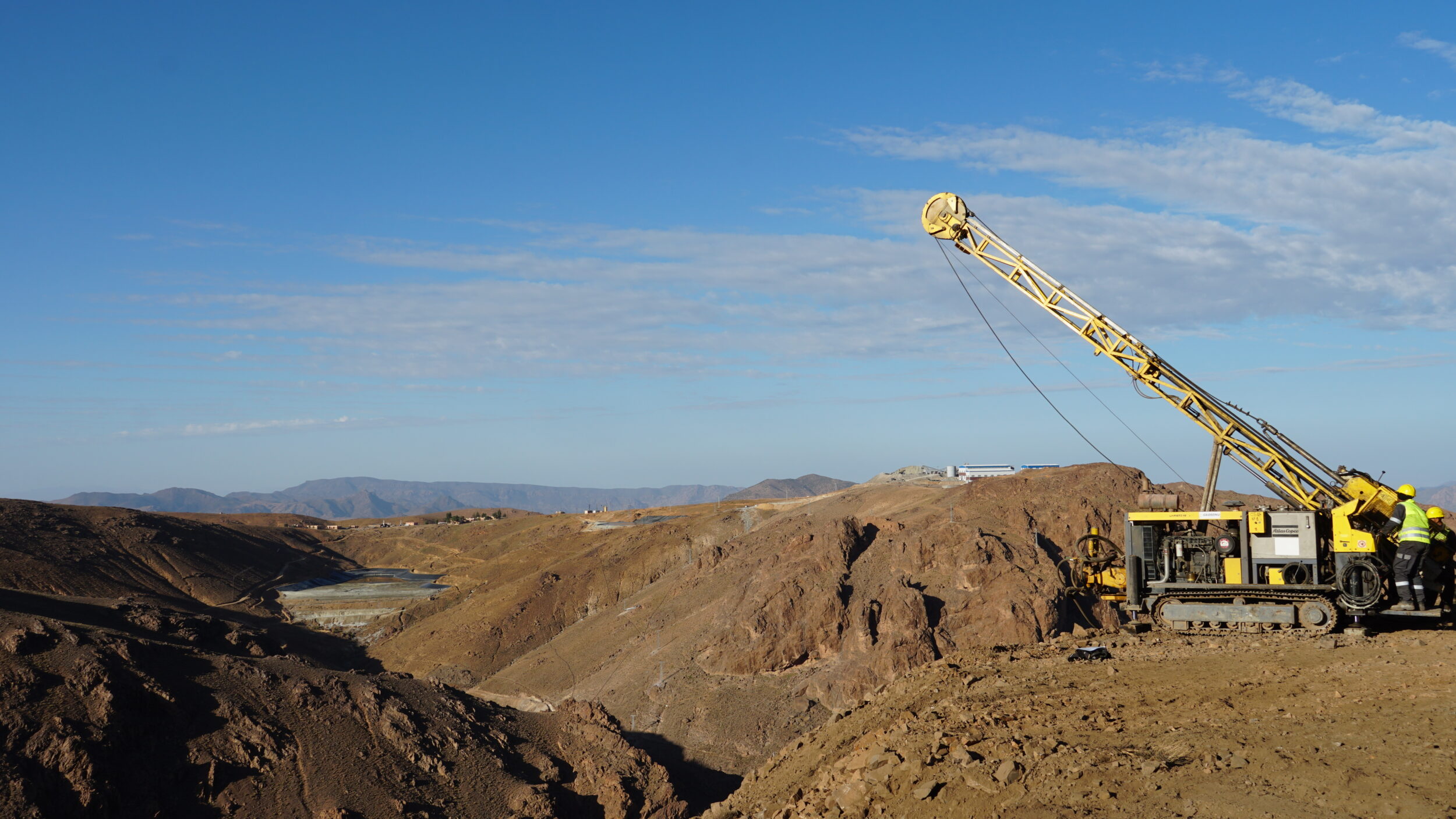
The main objective of the 2021 Zgounder exploration program is to identify new near-mine resources on strike and at depth to be included in the feasibility study and to support Zgounder’s first mineral reserve. The initial program comprises a 41,000-meter drill program, 35,000 meters of which on the mine permit and 6,000 meters on the regional exploration permits. In addition, regional exploration will start at Zgounder. This year’s program comprises 35,000 meters of diamond drill and 6,000 meters of RC drilling, the latter of which will only be carried out regionally.
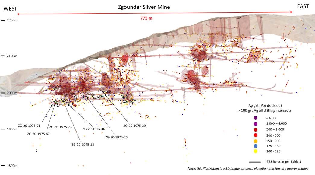
T28 Drill Traces and Point Cloud of Drill Data Greater than 100 g/t Ag