RAINY RIVER MINE
Overview
2021-PRODUCTION
New Gold’s Rainy River mine produced 58,557 ounces of gold in Q3 2021, a decrease of 7% compared to the prior-year period due to lower tonnes milled.
| Status: | Production (Commercial Production commenced November 2017) | Production (Commercial Production commenced November 2017) |
|---|---|---|
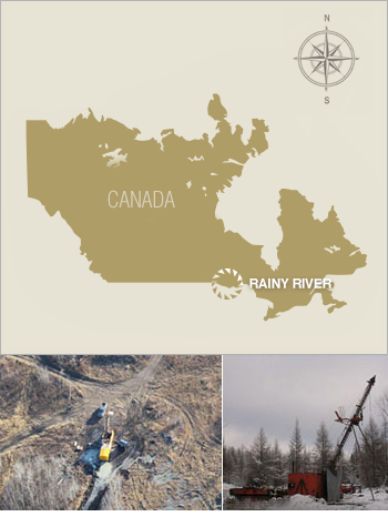
| Location: | 65 km northwest of Fort Frances, Ontario, in the southern half of Richardson Township | 65 km northwest of Fort Frances, Ontario, in the southern half of Richardson Township |
| Ownership: | 100% New Gold | 100% New Gold |
| Reserves1: | Gold | 2.6 million ounces |
| Silver | 7.2 million ounces | |
| Resources2: | Gold | 2.0 million ounces |
| Silver | 5.1 million ounces |
^1 Proven and Probable Mineral Reserves as of December 31, 2020
^2 Measured and Indicated Resources are exclusive of Mineral Reserves (Excludes Inferred Resources) as of December 31, 2020
See Mineral Reserves and Resources Summary as of December 31, 2020 for additional details including a breakdown by category.
| Annual Production: | |||
|---|---|---|---|
| Rainy River Mine | 2019 | 2020 | 2020 |
Gold (thousand ounces) | 254 | 229 | 229 |
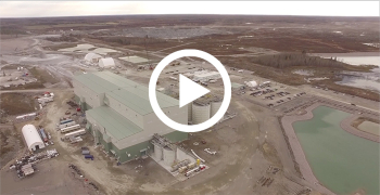
Rainy River Flyover
Site History
Rainy River commenced processing ore on September 14, 2017 and completed its first gold pour on October 5, 2017. Commercial production followed on October 19, 2017. Development of the underground mine began in the second half of 2018.
The mine occupies approximately 6,050 hectares, comprising 87 patented mining rights and surface rights claims (including eight leasehold interest mining rights and/or surface rights claims). In addition, New Gold has a land package of approximately 17,240 hectares surrounding the mine site, including patented mining rights and/or surface rights and unpatented claims. All unpatented claims are in good standing and assessment work credits are sufficient to maintain that standing for several years.
Geology, Exploration, Technical Reports
Rainy River - Geology, Exploration, & Technical Reports
Geology & Mineralization
The Rainy River district comprises multiple volcanogenic-style gold deposits situated within the Late Archean Wabigoon Subprovince of Ontario. Local stratigraphy comprises a series of tholeiitic mafic volcanic rocks structurally overlain by calc-alkalic dacitic metavolcanic rocks that host the bulk of gold mineralization in the district.


Mineralized zones generally follow the regional northwesterly strike and southerly dip of stratigraphy. The largest of these, the ODM/17 Zone, extends 1,600 metres along strike, 975 metres down dip (open at depth), and has a true width of 200 metres. Three principal styles of gold mineralization have been identified at Rainy River: gold-bearing sulphide ± quartz stringers and veins in felsic quartz-phyric rocks, (ODM/17, Beaver Pond, 433 and HS Zones), quartz-ankerite-pyrite shear veins in mafic volcanic rocks (CAP/South Zone), and sulphide-bearing silver-enriched quartz veinlets in dacitic tuffs and breccias (Intrepid Zone). Most of the gold mineralization identified to date occurs in the sulphide bearing stringers and veins within the felsic quartz-phyric rocks. A fourth style of mineralization characterized by copper-nickel-platinum minerals occurs within a small, younger mafic-ultramafic intrusion (34 Zone) situated within the main cluster of gold and silver deposits. All deposits show some degree of deformation, excepting the copper-nickel-platinum-bearing type.


Exploration Potential
The Rainy River project represents one of Canada’s newest emerging gold districts. The Rainy River district was first explored for nickel sulphide style mineralization in the mid-1960s. The eventual recognition of the district’s gold potential in 1988 led to the discovery of gold mineralization in what has become a large system of stratiform gold-rich volcanogenic style sulphide deposits. After three years of commercial production, the Rainy River Mine accounts for 2.6 million ounces of gold reserves and an additional 2.0 million ounces of measured and indicated resources1.
In March 2021, the Company completed an early-stage reconnaissance drilling program designed to test targets of coincident geochemical soil anomalies, magnetic geophysical anomalies, and evidence of quartz veins and/or shear zones within the North East Trend area located approximately 15 kilometres north from the Rainy River Mine. Results to date define narrow intervals of gold bearing mineralization, supporting the preliminary geological and geochemical interpretations.
As we compile additional data and complete interpretations of all reconnaissance drilling, follow-up drilling is planned to commence in the second half of 2021. Field exploration activities have also been planned to refine follow-up drill targets, inclusive of soil geochemical survey, geological survey, geological mapping, and trenching.
Additionally, New Gold's exploration efforts focuses on identifying and generating new targets to define additional mineralization within the broader Company's landholdings and potentially extend the commercial life of the mine.
^1 Measured and Indicated Resources are exclusive of Mineral Reserves (Excludes Inferred Resources) as of December 31, 2020
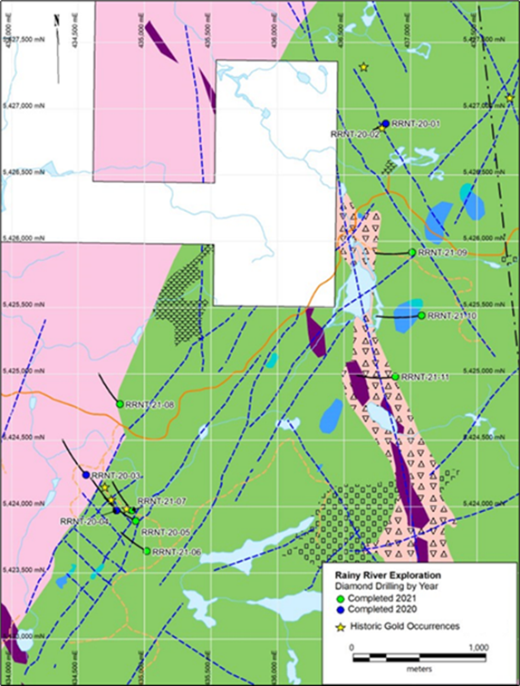
North East Trend area drill holes location
Technical Report