PARDO GOLD PROJECT
THE FIRST IMPORTANT PALEOPLACER GOLD DISCOVERY IN NORTH AMERICA
Exploration Target
Inventus is targeting numerous surface and near surface exposures of gold-bearing conglomerates on the Pardo Property. The conglomerate “reefs” are extensive, flat lying layers ranging from 1 to 4 metres thick.The gold-bearing conglomerates, if economically feasible, would be subject to low-cost surface strip mining methods.
Inventus’ 2018 Technical report outlined three exploration target ranges for the gold-bearing conglomerate in terms of pessimistic (P10), moderate (P50) and optimistic (P90). see table below.

The potential tonnages and grades are conceptual in nature and are based on surface mapping, drilling and channel sampling results that define the approximate thickness, extent and grade of the mineralized conglomerate unit. Currently there has been insufficient exploration to define a mineral resource.
Bulk Sampling
Inventus is currently pursuing a 50,000 tonne advanced exploration bulk sample program at Pardoto build confidence of the gold grade. In late 2017 Inventus conducted its first bulk sample at Pardo from the Trench 1 Occurrence. The 1,000 tonne sample was calculated to contain 133.8 ounces of gold, equivalent to 4.2 g/t. Diamond drilling prior to extraction of the bulk sample returned an average grade of 1.34 g/t gold representing a >200% increase in grade from the bulk sample.
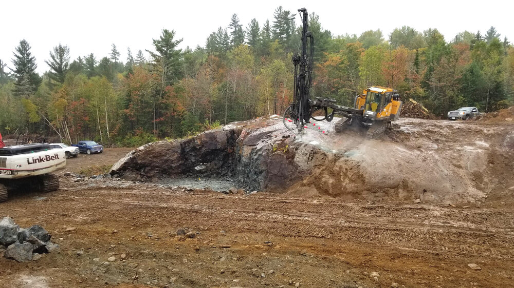
Trench 1
1,000 Tonne Bulk Sample
1.34 g/t drilling grade 4.2 g/t bulk sample grade
Occurrences
View fullsize
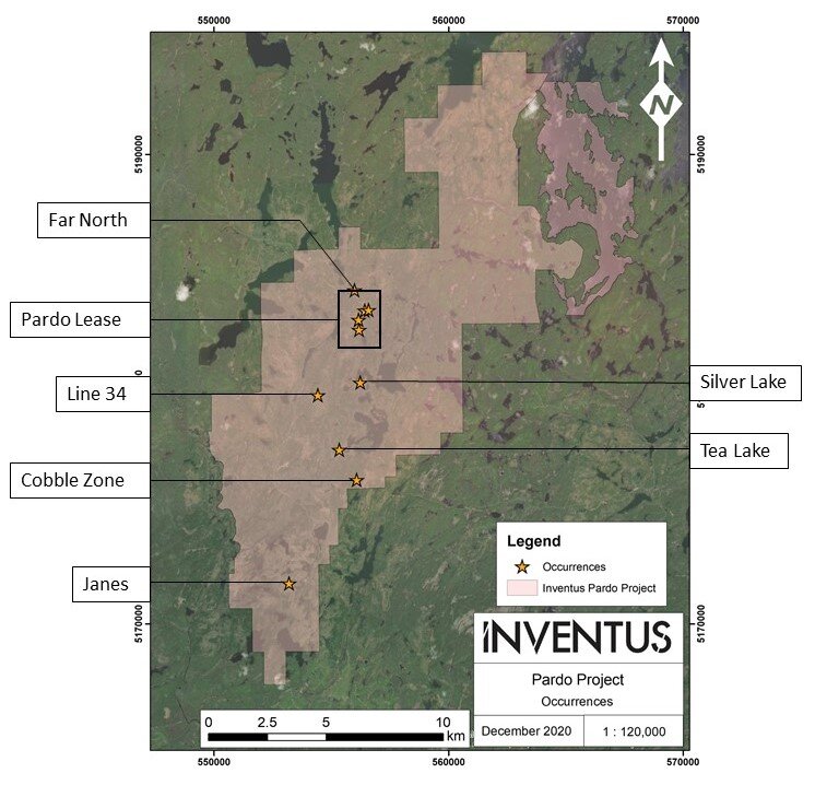
The highest grade occurrences to date have been the 007, Eastern Reef and Godzilla Zones. Surface channel sampling highlights from these areas include:
- 36.5 g/t gold over 31 metres at the 007 Zone
- 4.2 g/tgold over 92.5 metres at Eastern Reef
- 5.2 g/t gold over 140 metres at the Godzilla Zone
Pardo Lease Area
View fullsize
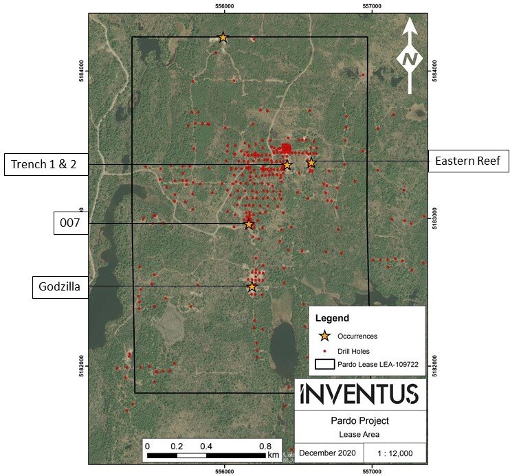
The maps below illustrate the channel sampling in greater detail


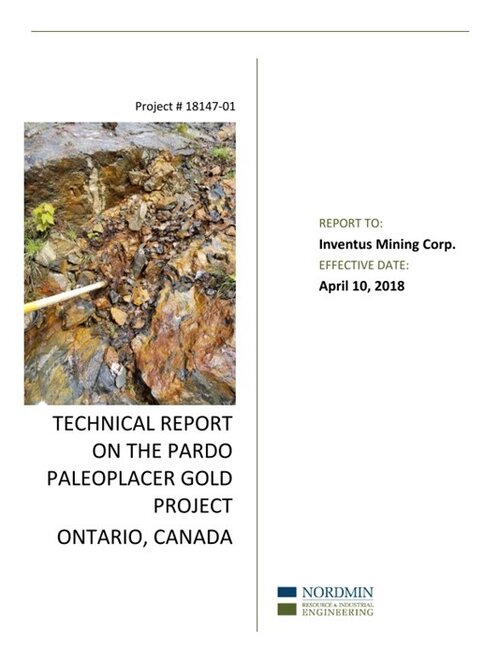
Pardo Project - NI 43-101 Technical Report 2018
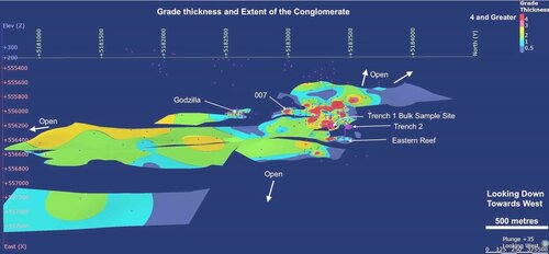
3D Pardo Model in Leapfrog®
Location and Access
The Pardo Paleoplacer Gold Project is located in Ontario, Canada, 65 km north east of the world class mining district of Sudbury. The property has excellent year round access by road, which is less then 1.5 hours from Sudbury.


[ ](https://maps.google.com/maps?ll=32.008847,-104.369064&z=3&t=p&hl=en&gl=US&mapclient=apiv3 "Open this area in Google Maps (opens a new window)")
Map data ©2021 Google, INEGI
1000 km
Property Ownership
The Pardo Project consists of a 3.8 sq. km block of mineral leases and 180 sq. km's of mineral claims covering the target paleoplacer geology.
Geology
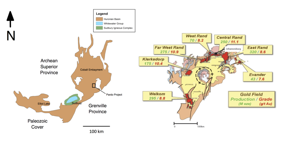
The Pardo Project is a conglomerate-hosted gold deposit within rocks of the Huronian Supergroup, a 2.4 billion year old sedimentary basin. Ancient Precambrian Sedimentary basins such as the Huronian are known to contain large paleoplacer gold deposits. One such setting is the famous Witwatersrand basin in South Africa, which is the largest gold provenance in the world, having produced over 1.5 billion ounces of gold.
Huronian Basin, Ontario (left) Compared to the Witwatersrand Basin, South Africa (Right)
View fullsize
Inventus has identified gold bearing conglomerate reefs within two separate formations. The conglomerate reefs are extensive, flat lying layers ranging from 1 to 4 metres thick. In some areas these reefs are stacked and separated by interbedded sandstone. The basal Matinenda Formation is composed of pyritic quartz pebble conglomerate and underlies the Mississagi Formation, a polymictic cobble to boulder conglomerate. The two formations contain anomalous gold values over the entire property that spans 13 km north-south and 3 to 5 km east-west.
View fullsize
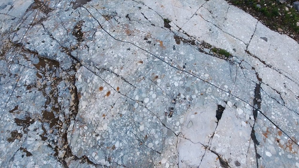
Gold-bearing Mississagi Fm. conglomerate from the Godzilla Zone.
Academic Research on the Pardo Paleoplacer
Pardo Research Paper
“The discovery of basal and intraformational conglomerate-hosted gold mineralization in the Huronian Supergroup’s Mississagi Formation near Sudbury, Ontario, has indicated potential for Witwatersrand-type gold mineralization
— Whymark & Frimmel, 2