IMTER BIS
Imiter bis, formerly known as 233263 Permit, is an exploration property located on Morocco’s sub-Atlas range, about 150 kilometers from Ouarzazate and just five kilometers south of the world-class Imiter Mine.
Profile
The permit area is underlain by the Ouarzazate Supergroup which consists of the Jbel n’Habab complex: an assemblage of andesitic to dacitic lavas and tuffs (570 Ma) overlain by the by the Takhatert complex including ignimbrites, conglomerates and pyroclastic rocks (550 Ma).
The Takhatert complex is similar in age to the PIII rhyolites, porphyres and ignimbrites associated with the Bou Madine (Au, Ag, Cu, Zn and Pb) deposit (554 Ma) located 80 km to the east in the Ougnat “boutonnière”.
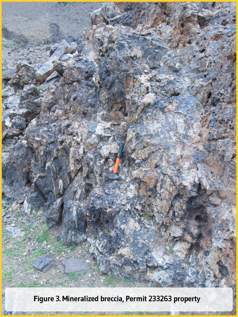
The main Au, Ag, Cu, Zn and Pb mineralization is related to brecciated and cataclastic limonitized, hematized and silicified zones carrying galena, sphalerite and chalcopyrite (Figure 3).
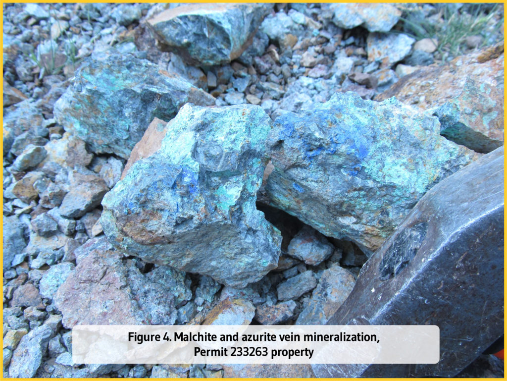
Throughout the rhyolites, rhyolitic tuffs and ignimbrites of the Takhatert complex, numerous quartz-iron oxide veins are exposed in trenches which are mineralized in Cu (chalcopyrite, chalcosine, azurite and malachite), Pb (galena), Zn (spahlerite) ± Ag ± Au (Figure 4).
Location
The exploration area is located in the Proterozoic Saghro “boutonnière” of Morocco’s Sub-Atlas range, about 260 kilometers east of Marrakech and five kilometers south of the world-class Imiter Mine (Figure 1).
Access
The village of Imiter lies approximately 120 kilometers from Ouarzazate. A series of roads lead from Imiter to the southern and northern ends of the property, which are less than 20 kilometers away.
Surface area
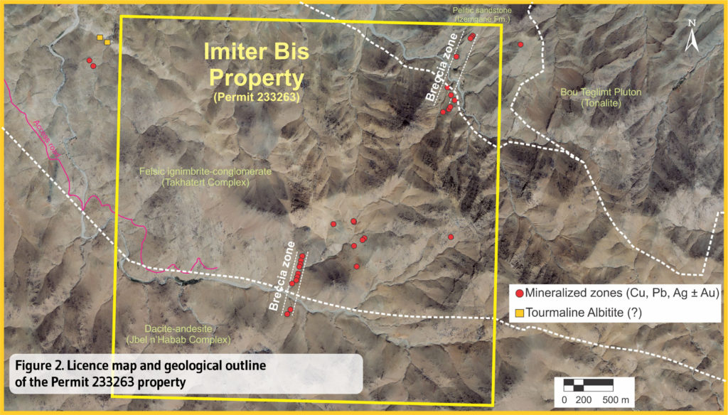
The property consists of one exploration permit covering 16km² (Figure 2).
Production
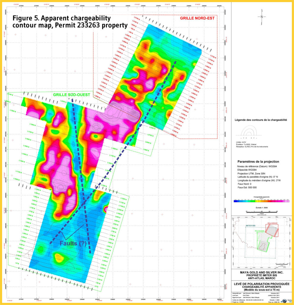
In 2012, 62 kilometers of grid lines covering the central part of the permit were submitted to an induced polarization/resistivity survey. Two main geophysical domains were revealed by the IP contours, reflecting a change in lithologies (Figure 5). The transition between the two domains is defined by a NNE-SSW-oriented structure. Several IP axes are observed near the NE breccia zone recognized by Ciesielski et al. (2011). They may reveal potential polymetallic mineralized zones. In general, IP inversion models indicate near-surface or shallow-depth anomalous areas (Simard, 2011).
Geological and Structural Framework
The Neoproterozoic rocks are divided into two lithostratigraphic units:
1) the Anti-Atlas Supergroup, including the Saghro Group (PI; 661-762 Ma); and
2) the Ouarzazate Supergroup (PII), a late syn- to post-tectonic, continental volcanic and clastic sequence, associated with high-K calc-alkaline to shoshonitic and alkaline magmatism (600- 531 Ma).
In the Imiter area, the PI assemblage is represented by sandstone, siltstone, quartzite, pelitic sandstone, black clay and tuff (Izemgane Formation). The sediments are intruded to the north by the Neoproterozoic (PII) Taouzzakt and Bouteglimt plutons. The Ouarzazate Supergroup consists of the Jbel n’Habab complex; an assemblage of andesitic to dacitic lavas and tuffs (570 Ma) overlain by the Takhatert complex including ignimbrites, conglomerates and pyroclastic rocks (550 Ma) (Figure 2). The volcanosedimentary assemblages are commonly intruded by NS to N40°-oriented dykes related to the granitic plutons and by Jurassic dolerite dykes. Rocks of the Permit 233263 property were affected by the Panafrican tectonism and are folded into large anticlines (D1). A strong S1 schistosity (NE-SW-oriented) dips steeply to the north. D2 tectonism is associated with fracture schistosity and forms N110°-N130° folds with NW-plunging axes. Two major fault systems, one oriented NE-SW parallel to S1, and the other N-S, are visible on the property.
Mineralization
Ciesielski et al. (2011) described an Au, Ag, Cu, Zn and Pb mineralization related to brecciated and cataclastic limonitized, hematized and silicified zones carrying galena, sphalerite and chalcopyrite (Figure 3). One zone extends for at least 700 meters and varies in width from 1-2m, locally up 10 meters. There is a highly brecciated and altered corridor that locally shows decimeter-size quartz veining with pseudo-crustiform or ribbon structures with fragments of dolomite and brecciated hematitic dolomite. Assay results from eight rock samples collected by Ciesielski et al. reveal moderate concentrations of precious metals: Ag =1 to 27 g/t and Au=0.021 to 2.78 g/t. Three high Pb (1.18 to 2.76 wt. %) and Zn (0.83 to 1.80 wt. %) values are reported.
The rhyolite, rhyolitic tuffs and ignimbrites of the Takhatert complex expose several quartz-iron oxide veins that are mineralized in Cu (chalcopyrite, chalcosine, azurite and malachite), Pb (galena), Zn (sphalerite) ±Ag±Au (Figure 4). Numerous trenches and small pits were investigated. One sample of a quartz-carbonate-hematite-goethite vein enriched malachite-azurite-hematite+pyrite±galena collected from a recently dug pit provided the following assays: 0.12 g/t Au, 29 ppm Ag, 2.10 wt. % Cu, 0.25 wt. % Pb and 0.03 wt. % Zn.