GUIGUI PROJECT
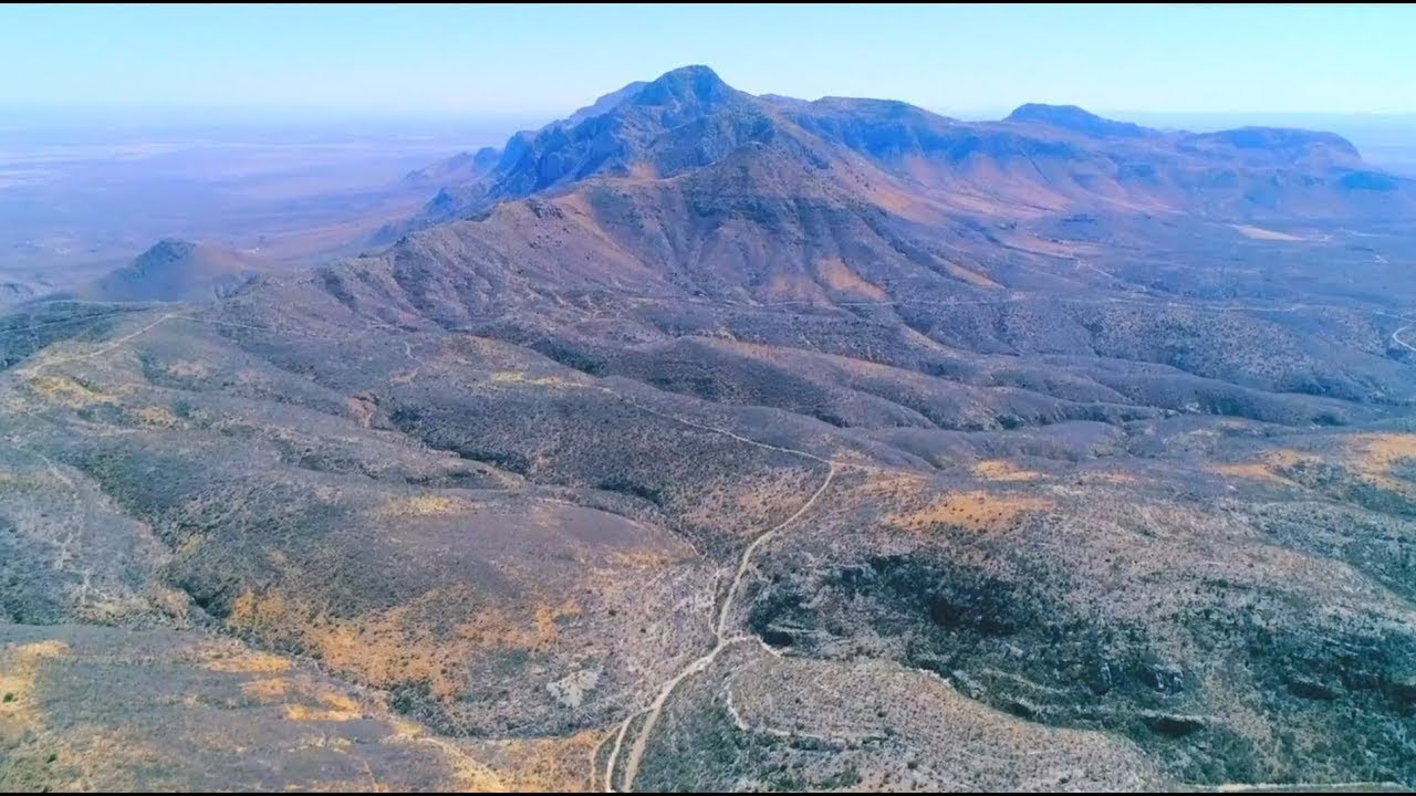
Overview
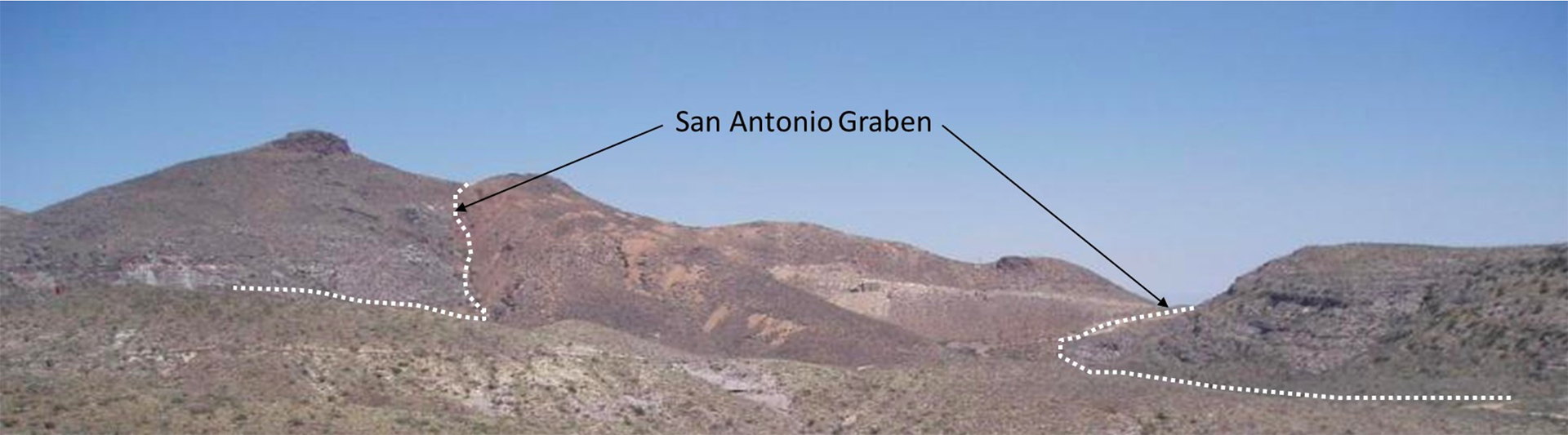 Panoramic view from the northern limit of the Guigui Property showing the San Antonio Graben
Prime Location.
Located in Chihuahua, Mexico with an area of 4,750 hectares and covers a major portion of the Santa Eulalia Mining District, the world’s largest known Carbonate Replacement Deposit (CRD) system.
Historically-rich Mining District.
Santa Eulalia Mining District has a recorded pro- duction of nearly 450 million ounces of silver and substantial amounts of lead and zinc mined from the period 1702-2001.
District-scale project.
Project has large land position South and Central to major mining areas to accommodate the exploration of the district scale CRD.
Great Exploration Potential.
The initial 12,000-meter drill campaign is currently underway. Exploration will continue to search for the concealed intrusive center of the CRD considered to be related to the district scale mineralization.
Location
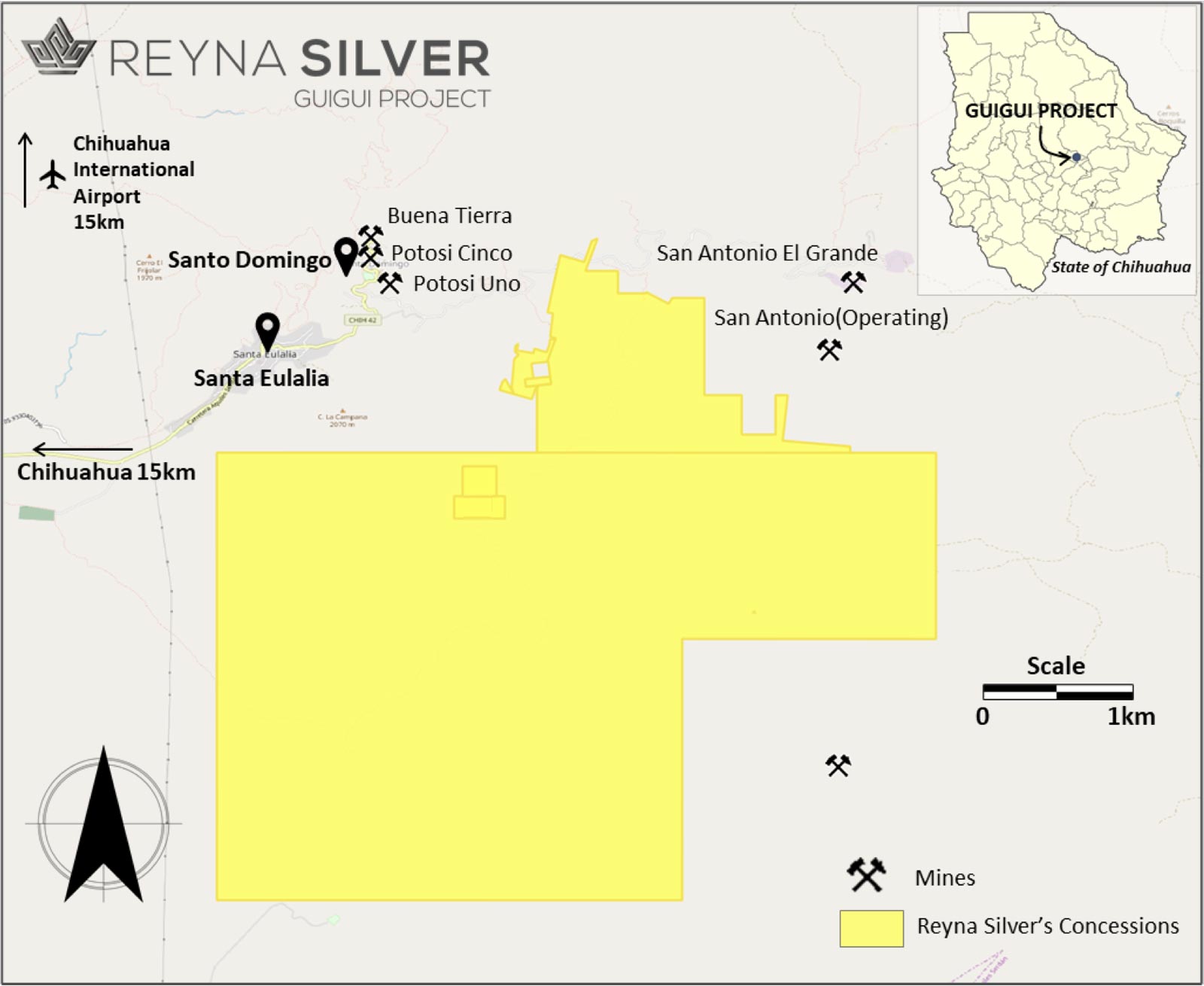
The project is located 15 km east of Chihuahua City: a major industrial and mining center.
Other populated centers near Guigui are the towns of Santa Eulalia (or Aquiles Serdán) and Santo Domingo (or Francisco Portillo).
The Chihuahua International Airport is about 25 minutes away from the property. It receives numerous daily flights from USA and parts of Mexico.
Toll Milling operation in the Potosi Mine adjacent to Guigui and La Chinche.
Paved and hard surface roads lead to Guigui and neighboring mines. Property is crossed by a series of well-maintained ranch roads.
Geology
Mineralization
The Santa Eulalia District is the largest known Carbonate Replacement Deposit (CRD) in Mexico and the largest among the CRDs that define a belt running from Hidalgo to near the Chihuahua-U.S.A border (Table 1).
Carbonate Replacement Deposits are Phanerozoic, high-temperature (>250 °C) deposits that comprise major pod, lens, and pipe-shaped Pb-Zn-Ag-Cu-Au-sulfide orebodies that cut across their host carbonate rocks. They are dominantly composed of a simple assemblage of galena, sphalerite, chalcopyrite, arsenopyrite, pyrite and/or pyrrhotite with subordinate carbonate, sulfate, fluorite and quartz gangue. A model of the CRD was established and developed by Dr. Peter Megaw from his dissertation studies at the Santa Eulalia.
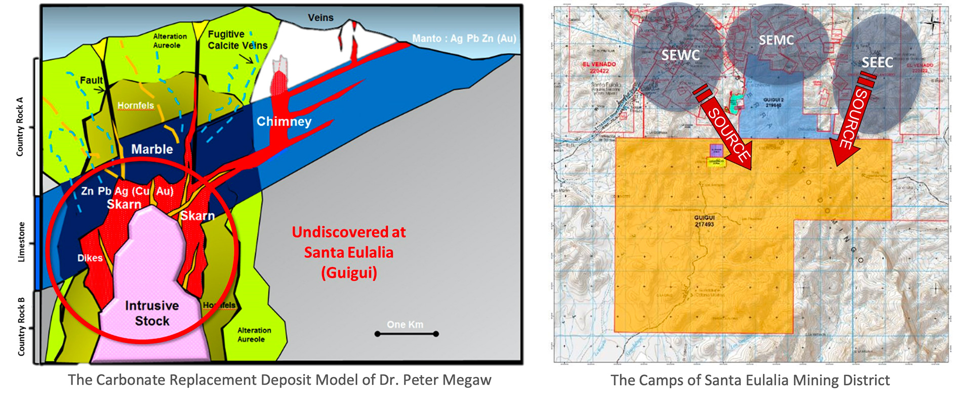
The mining district is divided into three camps—West, East and Middle Camps. Guigui Project lies immediately to the south of these camps:
- West Camp (SEWC) - Principal past producers in the camp are Grupo Mexico’s Buena Tierra Mine and MINA- MEX’s Potosi Mine.
- East Camp (SEEC) - Production is dominated by Grupo Mexico’s San Antonio Mine, which is currently in production.
- Middle Camp (SEMC) - The 2.5-km zone between SEWC and SEEC; Contains numerous mineralized showings and small mines but has not been systematically explored.
The East and West Camps contain continuous, zoned mineralization and alteration closely associated in time and space to groups of apparently identical felsite intrusions. Although the mineralization in the two camps does not overlap in space, both appear to have resulted from the evolution of persistent, pulsating, hydrothermal systems. The morphology of the felsites coupled with mineralogical, metals content, metal ratios, sulfur isotope, and mineralization style, strongly indicates a common hydrothermal source for the two camps. This source appears to lie between the two camps, immediately north of the Santo Domingo caldera (Megaw, 1990).
History
Gallery
Presentation
Report