AZEGOUR
The Azegour Mine is located at an altitude of 1,525 meters on the northern side of the Western High Atlas mountains, 80 kilometres south-southwest of Marrakech. The mine, which was operated periodically since 1931, has been a significant producer of base metals. Aya holds a 100% stake in the property in addition to both an exploration and a mining permit.
Profile
The site was most intensively mined between 1931 and 1947. Historical documents report that approximately 500,000 tonnes of ore were processed during that time. The cut-and-fill method used at the mine yielded an average of 2,270 tonnes of ore per vertical metre over 200 metres of elevation. A 2006 historical resource estimate for molybdenum, copper, and uranium produced the values cited below:
| Mineral | Tonnage (t)* | Mined (t) | Grade (wt. %) | Historical Resources (t)* | Grade (wt. %) |
|---|---|---|---|---|---|
| Molybdenite | 1,500,000 | 500,000 | 0.35-0.40 (Mo) | 1,000,000 | 0.35-0.40 (Mo) |
| Chalcopyrite | 1,200,000 | 800,000 | 3.00 (Cu) | 400,000 | 3.00 (Cu) |
| Scheelite | 329,000-500,000 | 50,000 | 0.35(WO3) | 270,000-450,000 | 0.35(WO3) |
| Uraninite | — | 120 | 1.00 (U3O8) | — | — |
* These resources are considered historical as per NI 43-101 standards of disclosure for mineral projects. A qualified person has not done sufficient work to classify the historical estimate as current mineral resources, the issuer is not treating the historical estimate as current mineral resources, and the historical estimate should not be relied upon.
Location
The Azegour mine is located in the Occidental range of the High Atlas mountains, 80 kilometres south-southwest of Marrakech. The project lies 12 kilometres south of our Amizmiz property.
Access
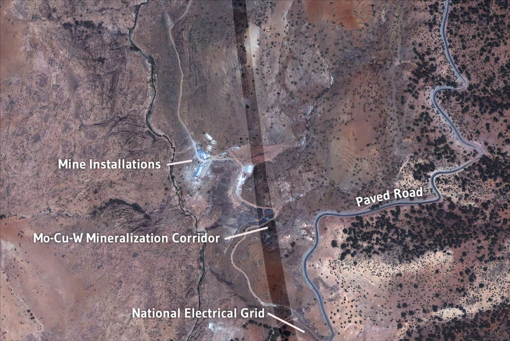
From Marrakech, a paved highway runs across the Haouz Plain to the town of Amizmiz from where a narrow paved road branches westward for eight kilometres to an intersection near the village of Azegour. The old mine entrance is located 400 metres north of the intersection on a dirt road (Figure 1).
Surface area
The property consists of a mining permit (183208) covering 16km² and an exploration permit.
Geological and Structural Framework
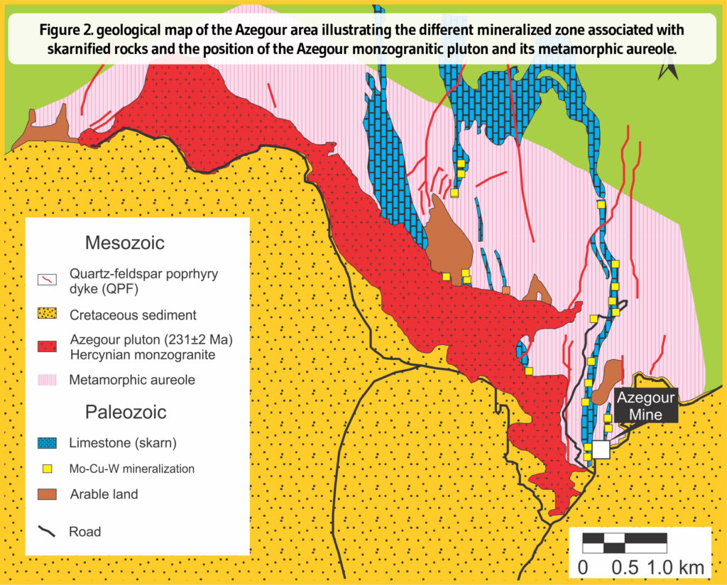
Azegour is a skarn deposit formed by the emplacement of the Hercynian Azegour monzogranitic intrusion (273±2 Ma) into Lower Cambrian folded volcanic and sedimentary rocks (limestones and schists). Molybdenite (Mo), chalcopyrite (Cu) and scheelite (W) mineralization is located within the metamorphic aureole of the monzogranite and impregnated in calc-silicate rocks (Figure 2). The intrusion presents two major facies:
- a fine-grained granite located on the border of the intrusion or included as blocs in the second facies and
- a dominant facies composed of a coarse-grained homogeneous monzogranite.
The contact between the monzogranite and the Paleozoic volcanosedimentary rocks is extremely sharp. Several fractures are filled by small mafic to porphyry felsic dykes and hydrothermal veins.
Mineralization
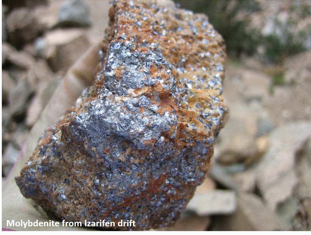
Molybdenite, scheelite, chalcopyrite and accessory mineralization containing uranium, nickel and cobalt are all located within the metamorphic aureole surrounding the Azegour intrusion. The Mo-W-Cu mineralization is impregnated in calc-silicate rocks formed by grenatites and pyroxenites. It presents itself as irregular pods extending in a N-S direction. Molybdenite is associated with grossular-bearing hornfels (Figure 3); scheelite is present in phaneritic andradite- bearing grenatite (Figure 4); and chalcopyrite is found in pyroxene hornfelses (Figure 5).