DOLLY VARDEN SILVER PROPERTY
Dolly Varden Silver Corporation owns 100% of the Dolly Varden Mines historic silver property. The current favourable price of silver has renewed investor interest in this most historic of the silver mines in the Northwestern BC region. The property is best considered an advanced exploration stage property with well understood targets. Mine restarts will require the discovery of additional silver mineral resources and the confirmation of historic mineral resources that were known at the cessation of mining in 1959.
Geological work commissioned in the period 1979 to 1990 established the common geological characteristics of the major silver deposits and occurrences in the upper Kitsault Valley. The rock formations and the style of the mineralization and alteration on the Dolly Varden property share strong similarities to the nearby Eskay Creek deposit, which is an exceptionally rich gold and silver deposit, located 100 km north of the Dolly Varden Property.

- 8,800 hectares (88 km2)
- 100% owned
- Four historically active mines
- Under-explored sectors – only 3% of property explored in detail
- Well understood targets
- 20 M Ag historic production
- Region with world-class projects
- Catalysts for higher valuation
- Northwestern BC region capturing new interest

The Way Forward – Targeted Exploration Programs
Validation and expansion of historical resource estimates
Identification of new Eskay type deposits:
- four targets
- Mineralization zones of 5-20m true widths
- Potential for high grade silver at depth
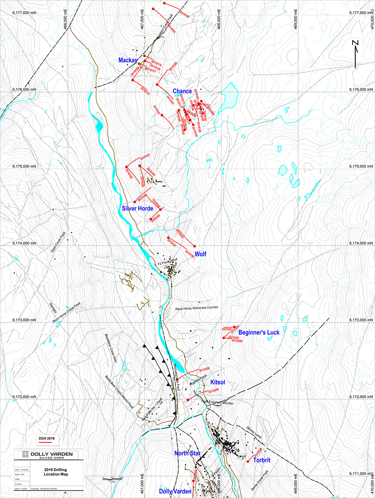
- Focus on Wolf and Torbrit zone
- New deposit identification:
- Largest alteration trend in district: 5km strike length on Property
- Potential for gold-silver VMS at depth beneath intense Red Point alteration zone.
The technical information in this website has been approved by Robert van Egmond, P.Geo., Chief Geologist of Dolly Varden and a Qualified Person.
[
Updated Mineral Resources Estimate – May 8th, 2019
| Search | Search | Search | Search | Search | Search |
|---|---|---|---|---|---|
| Classification | Deposit | Cut-off (g/t Ag) | Tonnes | Silver (g/t) | Contained oz Ag |
| Torbrit | 150 | 2,623,000 | 296.8 | 25,025,000 | |
| Indicated | Dolly Varden | 150 | 156,000 | 414.2 | 2,078,000 |
| Wolf | 150 | 402,000 | 296.6 | 3,834,000 | |
| North Star | 150 | 236,000 | 262.8 | 1,994,000 | |
| Total Indicated: | 3,417,000 | 299.8 | 32,931,000 | ||
| Torbrit | 150 | 1,185,000 | 278 | 10,588,000 | |
| Inferred | Dolly Varden | 150 | 86,000 | 271.5 | 754,000 |
| Wolf | 150 | 9,500 | 230.6 | 70,000 | |
| North Star | 150 | 4,800 | 223.6 | 35,000 | |
| Total Inferred: | 1,285,300 | 277 | 11,447,000 |
*Mineral Resources are not Mineral Reserves. Mineral resources which are not mineral reserves do not have demonstrated economic viability. There has been insufficient exploration to define the inferred resource as an indicated or measured mineral resource, and it is uncertain if further exploration will result in upgrading the resource to a measured resource category. There is no guarantee that any part of the mineral resource discussed herein will be converted into a mineral reserve in the future.
**A 150 g/t silver lower cut-off was chosen to reflect conceptual underground mining and processing cut-off grade.
***Contained ounces may not add due to rounding.
****The resource estimation work reported herein was completed by Mr. Steven Nicholls, BASc., MAIG, with APEX Geoscience Ltd. (“APEX”) under the direct supervision of Mr. Andrew J. Turner, P.Geol., also with APEX. Both are independent geological consultants and Qualified Persons as defined by National Instrument 43-101.
****An updated Technical Report, consistent with National Instrument 43-101, will be filed onwww.sedar.cawithin 45 days.*