GOLD POINT PROJECT

Highlights:
- Intermittent small scale mining between 1882 and 1962 produced an estimated 74,000 oz gold;
- Existing workings are mostly open and dry to approximately 275 m below surface on both the Orleans (1020’ level) and Great Western Veins (900’ level);
- Thirty-five historical samples collected post-mining across the Orleans Vein, from the 960’ to 1020’ levels, reportedly averaged 0.389 opt gold; and,
- Historical production records indicate recoveries between 92% to 98% for gold and 53% to 82% for silver, through cyanidation.
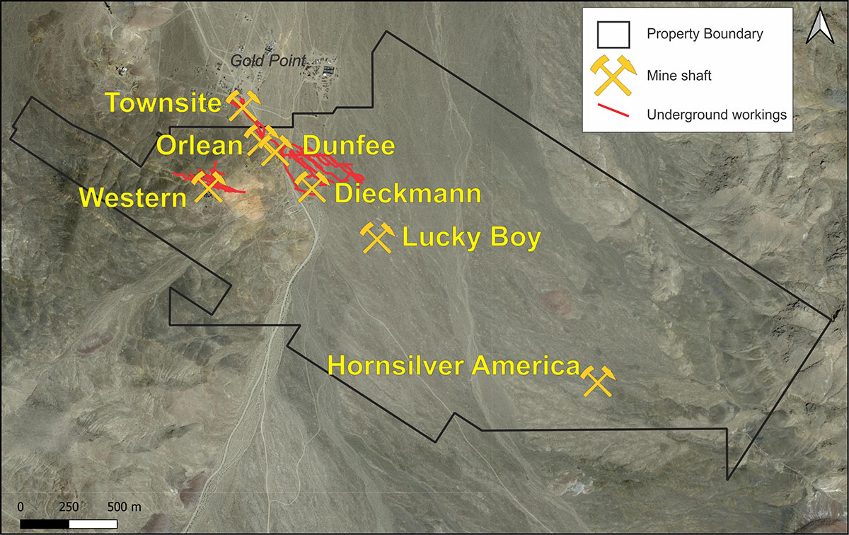
The Gold Point Project is located 26 miles south of Goldfield, Nevada, and covers several historical mine sites that intermittently produced gold and silver between 1882 and 1962. The first activity at Gold Point dates back to 1868, when prospectors discovered lime deposits, and subsequently silver, which was the primary commodity mined until approximately 1927 when deeper operations encountered more gold rich veins. Mining continued intermittently until 1942 when production was suspended by a government order related to the war effort. Operations resumed again in 1959 but were terminated when a cave occurred in 1962.
Since 1962, various operators have sought to reopen the mines and revitalize the district; however, there is no evidence that any systematic exploration has been conducted or significant mining done.
At least 15 significant veins have been historically reported in the district, while the majority of production within the bounds of the Gold Point Project was from the Orleans Vein and to a lesser extent the Great Western Vein.
The Orleans Vein was developed to the 1020’ level (approximately 275 m below surface), and produced an estimated 48,000 oz gold. Mining on the Orleans Vein ceased in 1962 when a cave occurred. Sampling done in 1982 from post-mining workings on the Orleans Vein reportedly includes:
- 35 samples from the 900’ to 1020’ levels averaging 0.389 opt gold and 1.44 opt silver;
- A sample from a 0.5 m wide vein on the 1000’ level returning 7.97 opt gold; and
- 21 samples from the 600’ to 1020’ levels averaging 0.314 opt gold an 1.42 opt silver, including a chip sample across 1.22 m grading 2.15 opt gold and 1.78 opt silver.
- The Western Vein was developed to the 900’ level (approximately 275 m below surface) and produced an estimated 27,000 oz up to 1922.
Exploration Plans
The objective of GGL’s initial exploration program is twofold. Firstly to characterize and delineate the veins within the immediate area of the existing workings, in order to determine what mineralization remains within and below the underground workings. Secondly to test along strike of, and parallel to the known veins in order to determine the potential of the entire mineralized system.
Early work will include: 1) detailed review and digitization of all available historical documents; 2) an airborne LIDAR survey to aid in locating and mapping existing workings at surface; 3) surveying, mapping and sampling of accessible underground workings; and 4) HLEM geophysical surveys across known veins and in prospective, overburden covered areas. Once priority targets have been established, the second phase of work is expected to include: 1) rehabilitation of underground workings, where necessary, in order to conduct underground drilling; and 2) reverse circulation percussion drilling from surface to test along strike and down-dip of known veins and in other target areas elsewhere on the property.