satellite data
---
promoted to 2ndary on jerry brown trump:
includes satellites in general
===
cnn
no lnx
The perfectly fine, already-paid-for satellites Trump wants to destroy in a fiery atmospheric reentry
By
Andrew Freedman
Aug 13, 2025
An artist's rendering shows NASA's Orbiting Carbon Observatory (OCO-2).
NASA is planning to decommission premier satellite missions that gather information on planet-warming pollution and other climate vital signs beginning as soon as October, sources inside and outside of the agency told CNN.
The destruction of the satellites — which will be abandoned and allowed to eventually burn up in a fiery descent into Earth’s atmosphere — marks the latest step by the Trump administration to scale back federal climate science.
President Donald Trump’s budget proposal takes a hatchet to NASA’s Earth science spending for fiscal year 2026, which begins in October.
The greenhouse gas monitoring missions, known collectively as the Orbiting Carbon Observatory, are some of the many Earth science casualties in the proposal.
Other satellites and instruments on the chopping block include the long-lived Aqua satellite, which carries a high-resolution Earth imaging instrument called MODIS, that among other uses, helps detect wildfires worldwide. Also at risk are the Terra and Aura missions, each of which have climate science applications, and planned satellites that would precisely measure solar radiation, heavy precipitation and clouds.
While the Trump administration says it is looking to end the OCO and other missions to cut costs, scientists involved in the projects see an anti-climate science pattern at work.
Dave Crisp speaks during an Orbiting Carbon Observatory-2 briefing in June 2014.
Congress is still considering Trump’s budget request and may reject some, or all, of the Earth science cuts, but NASA is proceeding as if the White House spending blueprint will be implemented as-written.
David Crisp, a former NASA scientist who worked on the OCO missions and managed them until he retired in 2022, confirmed the decommissioning planning for OCO-2 and OCO-3. Other sources, including one NASA employee, also confirmed this plan, speaking on condition of anonymity because they weren’t approved to discuss the issue.
NASA calls a mission’s closeout phase — the period when the program team works out how to end it — “Phase F.” The Phase F state of planning for the OCO missions was first reported by NPR.
In response to questions from CNN, a NASA spokesperson pointed to Trump’s budget request. “It would not be appropriate for us to comment at this time as the budget process is still happening. Should the budget pass as proposed — it still needs to make its way through Congress — this will be implemented upon the start of the next fiscal year.”
An expensive decision with global impact
A United Launch Alliance Delta II rocket launches with the Orbiting Carbon Observatory-2 satellite onboard in July 2014.
Together, the OCO-2, a free-flying satellite, and OCO-3, which is mounted on the International Space Station, measure the composition of the Earth’s atmosphere, specifically sniffing out climate pollution.
The OCO missions are particularly useful for tracking fossil fuel and ecosystem-related emissions, scientists told CNN. The instruments also help scientists monitor plant productivity — critical for farmers and the researchers studying forest loss.
While OCO-3 could be switched off and remain attached to the ISS, perhaps to be turned on again in the future, the decommissioning process for OCO-2 is far more complicated — and fiery. The satellite would be moved into a much lower orbit and exist there as space junk for years until it burns up in the Earth’s atmosphere.
The purposeful abandonment or destruction of multimillion-dollar satellites and instruments is essentially unprecedented, scientists told CNN. They are particularly baffled by the decision to destroy OCO-2, given it already has enough fuel on it to last through 2040.
The OCO missions are still functioning and are thought to have many years left of data-gathering, in addition to the fuel onboard, which has already been bought by American taxpayers. It is not business as usual to shut off working satellites without conducting a comprehensive review, sources told CNN, nor is it typical to kill functional spacecraft that can cost billions to put into space in the first place.
View of the Orbiting Carbon Observatory-3 (OCO-3) on the Japanese Experiment Module Exposed Facility of the International Space Station in June 2019.
“The reality is that as long as these instruments are producing high-quality data, it’s essentially unheard of to decommission the satellites, because keeping them going is so cheap compared to building them and launching them in the first place,” Anna Michalak, a climate researcher at Carnegie Science and Stanford University who works with greenhouse gas emissions data, told CNN.
The OCO missions are important for other countries, too, since they also use the data, Michalak said: “It’s not just that these are the only two NASA-funded missions. It’s that these have been the most impactful missions in this space, globally, period.”
Losing the OCO missions would hurt US leadership in climate science and create a multiyear gap in space-based climate pollution measurements, said Ben Poulter of Spark Climate Solutions, a nonprofit focused on climate risks and innovative fixes. Poulter was previously a NASA scientist and helped lead greenhouse gas monitoring efforts for the Biden administration.
“Losing these satellites prematurely gives away the leadership to Europe and to China in terms of monitoring CO2 concentrations and emissions,” Poulter said. Prematurely ending the OCO missions is consistent with the perception that the Trump administration “doesn’t want to do anything related to climate science and climate services,” he added.
Related article
In scathing letter, NASA workers rebuke ‘rapid and wasteful changes’ at agency
Crisp, the former NASA scientist, also told CNN that decommissioning so many Earth science missions at the same time fits a pattern.
“My guess is that they perceive these missions as missions that were designed for climate, for reinforcing climate hysteria or something,” Crisp said of the Trump administration. “They think these missions were designed for a regulatory reason, for example. But I want to point out NASA is not a regulatory agency.”
Billionaires to the rescue?
There are at least two possibilities for saving the carbon observatory mission, though researchers are not optimistic about either one coming to fruition.
The first is Congress. Lawmakers could reject Trump’s proposal and offer NASA the budget it needs to maintain US climate and Earth science status quo. Trump would also have to sign such a bill.
The second possibility is to create a public-private partnership that pays the expenses for maintaining these instruments and processing the data back on Earth. This could take the form of a philanthropic organization, a wealthy individual or perhaps a university taking over OCO-2 or OCO-3, or perhaps both, for a period of time.
The space agency has already issued a call for partnerships for OCO-3, and it is expected to put out a similar call for operating OCO-2 at some point this week, multiple researchers who work with OCO data said.
“There’s this scramble to see what can be done before any sort of decommissioning or Phase F protocols go into effect later this year,” Poulter said.
However, involving the private sector in operating OCO or other Earth-observing satellites can present complications, Michalak said, as it could diminish NASA’s role in providing an accurate backbone of Earth observations.
As the search for a partnership to save OCO-2 and OCO-3 begins, NASA only has less than two months to figure out how to keep the missions going.
Related article
The GISS facility is located at Columbia University’s Armstrong Hall in New York City.
NASA scientists describe ‘absolute sh*tshow’ at agency as Trump budget seeks to dismantle top US climate lab
Most read
Hurricane Erin to churn up life-threatening surf and rip currents along US East Coast and Bermuda
---
DUCK 8 25
- NPR
Trump administration takes aim at satellite that measures carbon ... - NPR
Aug 4, 2025The Trump administration has asked NASA staffers to draw up plans to end at least two satellite missions that measure carbon dioxide in the atmosphere, according to current and former NASA employees.
Share feedback about this site
AP News
https://apnews.com › article › trump-nasa-climate-satellites-34f533a1d28db954e30b2101d0ae186c
Trump moves to shut down NASA missions that measure carbon dioxide and ...
Aug 6, 2025The free-flying satellite, though, is at risk of being brought down, meaning it would burn up in the atmosphere. National Public Radio first reported that NASA employees were making plans to end the missions.
Share feedback about this site
CNN
https://www.cnn.com › 2025 › 08 › 13 › climate › nasa-satellites-trump-budget-cuts-weather
The perfectly fine, already-paid-for satellites Trump wants to ... - CNN
5 days agoThe destruction of the satellites — which will be abandoned and allowed to eventually burn up in a fiery descent into Earth's atmosphere — marks the latest step by the Trump administration ...
Share feedback about this site
PBS
Trump moves to end NASA missions measuring carbon dioxide and ... - PBS
Aug 7, 2025The Trump administration wants to end two NASA missions that monitor a potent greenhouse gas and plant health. The move would potentially shut off an important source of data for scientists ...
Share feedback about this site
Los Angeles Times
Trump moves to shut down NASA missions measuring carbon dioxide, plant ...
Aug 7, 2025The free-flying satellite, though, is at risk of being brought down, meaning it would burn up in the atmosphere. National Public Radio first reported that NASA employees were making plans to end ...
Share feedback about this site
Eos
NASA Planning for Unauthorized Shutdown of Carbon Monitoring Satellites
Aug 5, 2025Orbiting Carbon Observatory-2, illustrated above, would burn up in Earth's atmosphere if it were decommissioned. Credit: NASA/JPL-Caltech Research & Developments is a blog for brief updates that ...
Share feedback about this site
Scientific American
Three NASA Climate Satellites Are Dying. There's No Plan to Replace ...
Apr 11, 2025CLIMATEWIRE | The looming demise of three NASA satellites has scientists bracing for the loss of climate and atmospheric data — especially since there are no plans to replace some of the ...
Share feedback about this site
Mashable
https://mashable.com › article › nasa-trump-funding-carbon-observatory-satellite
NASA satellites tracking greenhouse gases may be ... - Mashable
Aug 4, 2025NASA employees are drawing up plans to shelve an ongoing space mission that tracks greenhouse gases and crop health, as the Trump administration takes aim at the agency's budget.
Share feedback about this site
ZME Science
https://www.zmescience.com › ecology › climate › white-house-satellite-climate-plant-heath
White House Wants to Destroy NASA Satellites Tracking Climate Change ...
7 days agoTrump Is Chopping Up NASA These two satellites are the only federally run instruments specifically designed to track planet-warming carbon dioxide from space.
Share feedback about this site
EHN
Satellites burning up in Earth's atmosphere could worsen climate change ...
May 6, 2025Most satellites are retired by burning up in the atmosphere, releasing pollutants. Researchers modeled the release of 10,000 tonnes of aluminium oxide annually by 2040 from satellite re-entries, predicting temperature changes up to 1.5C in the middle and upper atmosphere, reduced wind speeds, and ozone depletion.
---
Hackers could shut down satellites – or turn them into weapons
William Akoto, University of Denver
SpaceX and other companies are rushing to put thousands of small, inexpensive satellites in orbit, but pressure to keep costs low and a lack of regulation leave those satellites vulnerable to hackers.
==
GEDI soon
https://www.alternet.org/news-amp-politics/climate-science-denying-trump-regime-silently-killed-nasa-carbon-monitoring-system
==
==
Many climate change deniers debate whether humanity has played a significant role in changing environmental conditions. In the past, it has been difficult to parse out mankind's contribution to carbon emissions from changes caused by the Earth’s own natural climate system. Now, thanks to new research provided by a NASA satellite, we may have found the definitive answer to that question.
Using information gathered from NASA’s Orbiting Carbon Observatory-2 (OCO-2), a team of researchers from Michigan Technological University recently published the results of five studies in the journal Science. Due to the massive amount of data provided by this three-year NASA mission, the researchers have been able to track global CO2 emissions from both natural and industrial sources.
NASA's OCO-2 carries a single instrument consisting of three high-resolution grating spectrometers that measure properties of light within the electromagnetic spectrum. (image: NASA)
It’s all thanks to that industrious OCO-2 satellite. Since 2014, OCO-2 has been orbiting Earth over 14 times a day, gathering around 100,000 measurements each time and allowing scientists to observe CO2 concentrations in hard-to-reach areas such as the middle of the ocean and the Amazon rainforest. As a result, for the first time ever, we now have a complete map of how carbon dioxide moves around in our atmosphere, particularly with regards to how the gas is absorbed and emitted.
So what have we learned? For one, we now have an idea of how the shifting patterns in tropical Pacific Ocean temperatures that precipitate El Nino storms affect global CO2 levels. There’s also information on how plant photosynthesishas begun to respond to the increased amount of carbon present in the atmosphere. Another significant find from one of the studies has to do with CO2 produced by volcanic eruptions.
Power plants more harmful than volcanos
“Many people may not realize that volcanoes are continuously releasing quite large amounts of gas, and may do so for decades or even centuries,” saidvolcanologist Simon Carn, a Michigan Tech professor and a lead author of the study. “Because the daily emissions are smaller than a big eruption, the effect of a single plume may not seem noticeable, but the cumulative effect of all volcanoes can be significant. In fact, on average, volcanoes release most of their gas when they’re not erupting.”
In the past, this fact has been used to fuel a myth that volcanoes are the main culprits when it comes to the production of greenhouse gases. Until OCO-2, it’s been impossible to completely rule out this theory by measuring exactly how much carbon dioxide volcanoes produce. One of the published studies chose to focus on this precise question, and found that power plants actually contribute far greater amounts of CO2 to the atmosphere than passive volcanos do.
“The highest emitters [among] the volcanoes are equal [to], or superseded by, about 70 fossil fuel power plants on Earth,” Florian Schwandner, the paper’s lead author, told Bloomberg. “What that shows us is that volcanoes are likely not a significant source of CO2.”
Overall, the study found that volcanoes emit around 540 megatons of carbon dioxide a year—a paltry amount compared to the 38,200 megatons produced by humans.
Solving scientific puzzles
Equipped with this knowledge, we now have a much better picture of exactly how humans are changing the planet. In the past, for instance, using ground-based monitoring devices meant it was difficult to differentiate between urban and rural pollution. But with the data from the satellite, we now know that cities produce over 70 percent of humanity’s CO2 emissions.
“This is really a first for the carbon cycle community,” Abishek Chatterjee, a scientist at the University Space Research Association, told The Verge. Chatterjee co-authored one study that looked at how an El Niño had affected the ocean. A major question scientists sought to answer in the past was how CO2 levels changed during tropical storms in terms of land and ocean absorption. Thanks to OCO-2, Chatterjee said, “[we] have solved that critical scientific puzzle.”
The major implication of these findings is how they can help predict changes brought about by global warming—information that will assist policymakers to put forward plans to help communities be better prepared.
Another finding from one of the studies measured CO2 levels over Los Angeles. The results found that in winter, plants absorb less CO2, which means higher levels in the air. This observation may not seem particularly useful, but it highlights the speed with which the OCO satellite can scan cities for pollution and improve subsequent response times.
A great example of how this could help, explained Schwandner, has to do with monitoring active volcanoes. Having already observed the Yasur volcano in Vanuatu, researchers now have accurate measurements of how much CO2 the volcano produces a day. If those levels were to suddenly drastically rise—a clear sign of volcanic activity—scientists could predict an eruption. “We can’t stop a volcano, but we can evacuate people,” Schwander said. “And the earlier we get the heads-up, the better.”
This is just one example of the ways in which this innovation in CO2 observation might assist humanity in the future. While it’s not going to dig us out of the mess we're in, it brings us one step closer to identifying the extent of our climate change condition. And just maybe, with more knowledge will come acceptance, and who knows, maybe even action.
==
https://www.alternet.org/news-amp-politics/hurricane-harvey-trumps-weather-cuts-are-now-eye-storm
:{:{}:
}:
9/1/17
:{:{}:
}:
As Hurricane Harvey churned toward the Texas Gulf Coast last week, meteorologists, climate scientists and lay weather nerds on Twitter marveled at the crisp, detailed images of the storm sent to earth by a brand-new satellite. The nation’s first Geostationary Operational Environmental Satellite, GOES-16, had been launched from Cape Canaveral, Florida 11 days after the November election, and has since transmitted high-resolution pictures of smoke from Canadian wildfires, of the August 21 North American eclipse and of a major fog event that spread out over the Midwest and Eastern U.S. But it’s been the images of hurricanes — Hilary, Gert and now Harvey — that have most mesmerized and thrilled weather forecasters, who for the first time have been able to see the storms develop from tropical wave to threatening hurricane almost in real time.
GOES-16scans the earth every 15 minutes and tracks active storms at intervals as short as 30 seconds. It tracked Harvey as far back as August 17, when it was a tropical storm with 40 mile-per-hour winds approaching St. Lucia Island in the Caribbean.
“This new satellite will save lives,” said Todd McNamara of the U.S. Air Force 45th Weather Squadron, in a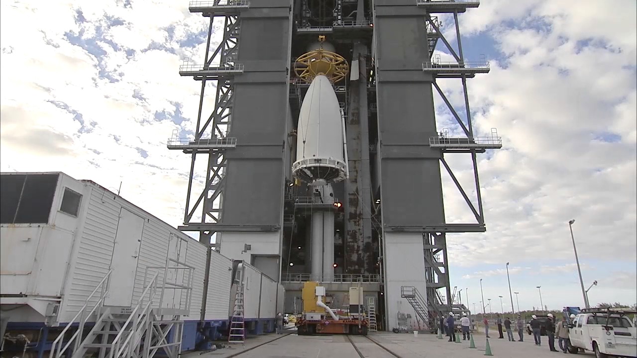 released last year.
If President Trump’s budget blueprint for fiscal year 2018 passes muster in Congress, however, the agency behind GOES-16, the National Environmental Satellite, Data and Information Service, could be facing lean times. Weather satellites take years to design and build, weeks to successfully launch (GOES-16 was delayed when Hurricane Matthew skimmed the Florida coast last year), and a well-funded staff of scientists to interpret and distribute data. The satellite agency, a division of the National Oceanic and Atmospheric Administration (NOAA), already gets less than it asks for every fiscal year. Trump has proposed cutting its roughly $2 billion budget by 18 percent.
A proposed budget in the U.S. House of Representatives would cut the satellite program even more steeply, by 23 percent, although the Senate budget only asks for a six percent reduction. The White House Office of Management and Budget insists the funding is enough to maintain the “current generation” of satellites. But the lack of commitment to the program reflects the administration’s ongoing hostility toward any science and research that might advance our knowledge of the earth’s climate — even when that research clearly saves lives. Here are four other ways that Trump’s priorities could make managing future disasters more difficult — and dangerous — in the U.S.
Canceling New Flood Risk Standards On January 30, 2015, President Barack Obama signed an executive order establishing a Federal Flood Risk Management Standard, an effort to shore up the nation’s defenses against the potential torrential rain and sea-level rise associated with the warming atmosphere. The order updated a 40-year-old order crafted before climate was an unavoidable issue, and directed federal agencies to revise flood maps and evaluate flood-avoidance rules for taxpayer-funded projects. It would have meant, according to the Association of State Flood Plain Managers, “that projects funded with taxpayer dollars do not have to be rebuilt time and again as we deal with increased rainfall and storm events.” On August 15, in an executive order streamlining infrastructure priorities, Trump revoked the order. Trump has also revoked two other Obama executive orders related to climate — one that helped states and local governments coordinate better with the federal government, and Obama’s June 2013 Climate Action Plan.
...
:{:{}:
}:
==
aug 2011
:{:{}:
}:
The Senate Appropriations Committee has rejected a proposal by the Trump Administration for a significant funding in a key NOAA weather satellite program.
Senate appropriators have provided $419 million for the Polar Follow-on (PFO) program for fiscal year 2018 (FY 2018). The program is aimed on developing two Joint Polar Satellite System (JPSS) spacecraft to follow two already funded JPSS satellites. The JPSS-1 satellite is scheduled for launch later this year.
The administration has proposed spending $180 million for the Polar Follow-on program. NOAA said it wants to “re-plan” the program to take into account other polar orbiting spacecraft, cost-saving measures and potential partnerships.
“Funding for PFO is critical for maintaining polar orbiting satellite data, which is already at risk for a potential gap due to program mismanagement and funding shortfalls in PFO’s predecessor programs,” according to the appropriations committee report.
“In light of the critical role that these satellites play in protecting American lives and property, the Committee finds it perplexing that the Department of Commerce and NOAA would propose to cut this program,” the report adds. “This cut, and the proposed but unspecified postponement of the JPSS–3 and JPSS–4 satellites, would introduce a weather forecasting risk that this Committee is unwilling to accept.”
The House Appropriations Committee has approved only $50 million for the program, far less than what the administration requested and Senate appropriators would provide.
House appropriators cited a lack of details about NOAA’s “dramatic and incipient re-plan” of the PFO program for the small budget allocation.
“Yet the request fails to assess the purported new mission design’s impacts on constellation availability, or to provide an updated gap analysis, or new annual or lifecycle cost estimates,” a committee report states.
“In the absence of these assessments and estimates, the Committee recommends $50,000,000 for the Polar Follow-On program. The Committee will reassess this funding level, should NOAA provide a new program plan and schedule, to include constellation availability assessments, gap analysis and updated annual and lifecycle cost estimates,” the report added.
Despite the disagreement on the PFO program, Congress and the White House are on the same page regarding two other weather satellite programs.
Senate and House appropriators approved the administration’s budget requests of $775.8 million for the JPSS program and $518.5 million for the Geostationary Operational Environmental Satellite-R ( GOES-R) program.
The White House and Congress at at odds on how much to spend on a commercial satellite weather data pilot program. The administration proposed spending $3 million on the program. House appropriators have provided $6 million while their Senate counterparts cut the request to $2 million.
There is also disagreement over NOAA’s space weather follow-on program, which aims to develop satellites to replace the DSCOVR spacecraft at the end of its lifetime.
The House bill would provide the space weather program $8.5 million while the Senate measure would provide $5 million. The administration proposed spending $500,000 on the program. It also proposed zeroing out funding for the DSCOVR satellite.
“The Federal Government needs an operationalized space weather architecture that allows sufficient warning times to protect our communications and electrical infrastructure from severe space weather events,” the Senate report states. “In architecting the follow-on missions, NOAA should consider using lower cost satellites, following NASA’s Explorer class model.”
==
https://www.scientificamerican.com/article/trump-administration-is-launching-a-weather-and-climate-satellite/
===
https://www.XXXguardian.com/science/2017/nov/05/donald-trump-accused-blocking-satellite-climate-change-research
:{:{}:
}:
:{:{}:
The Republican majority in the US Congress has been accused of deliberately obstructing research on global warming after it emerged that a critically important technique for investigating sea-ice cover at the poles faces being blocked.
The row has erupted after a key polar satellite broke down a few days ago, leaving the US with only three ageing ones, each operating long past their shelf lives, to measure the Arctic’s dwindling ice cap. Scientists say there is no chance a new one can now be launched until 2023 or later. None of the current satellites will still be in operation then.
The crisis has been worsened because the US Congress this year insisted that a backup sea-ice probe had to be dismantled because it did not want to provide funds to keep it in storage. Congress is currently under the control of Republicans, who are antagonistic to climate science and the study of global warming.
If Donald Trump won't tackle climate change, then Chicago will
Rahm Emanuel
Read more
“This is like throwing away the medical records of a sick patient,” said David Gallaher of the National Snow and Ice Data Center in Boulder, Colorado. “Our world is ailing and we have apparently decided to undermine, quite deliberately, the effectiveness of the records on which its recovery might be based. It is criminal.”
The threat to the US sea-ice monitoring programme – which supplies data to scientists around the world – will trigger further accusations at this week’s international climate talks in Bonn that the Trump administration is trying to block studies of global warming for ideological reasons.
Earth’s sea ice has shrunk dramatically – particularly in the Arctic – in recent years as rising emissions of greenhouse gases have warmed the planet. Satellites have been vital in assessing this loss, thanks mainly to America’s Defence Meteorological Satellite Programme (DMSP), which has overseen the construction of eight F-series satellites that use microwaves sensors to monitor sea-ice coverage. These probes, which have lifespans of three to five years, have shown that millions of square kilometres of sea ice have disappeared from the Arctic over the past 20 years, allowing less solar energy to be reflected back into space – and so further increasing global temperatures – while also disrupting Inuit life and wildlife in the region.
Trump is deleting climate change, one site at a time
Read more
At present three ageing satellites – DMSP F16, F17 and F18 – remain in operation, though they are all beginning to drift out of their orbits over the poles. The latest satellite in the series, F19, began to suffer sensor malfunctions last year and finally broke down a few weeks ago. It should have been replaced with the F20 probe, which had already been built and was being kept in storage by the US Air Force. However it had to be destroyed, on the orders of the US Congress, on the grounds that its storage was too costly.
Many scientists say this decision was made for purely ideological reasons. They also warn that many other projects for monitoring climate change, including several satellite missions, face similar threats from the Trump administration and Congress.
Such losses have serious consequences, say researchers. “Sea-ice data provided by satellites is essential for initiating climate models and validating them,” said Andrew Fleming of the British Antarctic Survey. “We will be very much the poorer without that information.”
The heading, standfirst and first paragraph of this article were amended on 8 November 2017 after an editing intervention erroneously accused President Donald Trump of obstructing satellite research into climate change. The Trump administration had nothing do with this as the decision was made by Congress in September, 2016.
}:
==
djt signed for weather sats?
11/17
:{:{}:
}:
:{:{JPSS-1 will help improve the timeliness and accuracy of U.S. weather forecasts three to seven days out as polar-orbiting satellites provide 85 percent of the data that goes into our numerical weather forecast models.}:
JPSS-1 data will help us track deadly hurricanes, monitor wildfires, watch the movement of sea ice in the Arctic, and measure changes in the ozone layer. It will also give us a clearer picture of harmful algal blooms and understand trends in the distribution and abundance of living marine resources off our shores.}:
:{:{==}:
}:
:{:{}:
}:
correction 140% worse
717
https://www.ecowatch.com/data-correction-climate-change-2450843224.html
:{:{}:
}:
---
The White House released its budget request for the 2018 fiscal year on Tuesday, the Trump administration made good on its promise to target deep cuts to federal spending on climate, energy, science, research and other programs widely seen as critical to America’s ability to adapt to a warming world and reduce its impact on the climate.
White House Budget Director Mick Mulvaney told reporters Tuesday that the government has been spending too much money on climate change and Trump’s proposed budget intentionally rebukes the Obama administration’s support for federally funded climate research.
“We want to do some climate science, but we're not going to do some of the crazy stuff the previous administration did,” Mulvaney said.
Trump, who has called climate change a hoax, has strenuously objected to the Environmental Protection Agency’s greenhouse gas emissions regulations created by the Obama administration. His budget reflects his vow to hamstring the EPA’s ability to control and monitor climate pollution by cutting its budget by about 30 percent — more than any other agency.
The $4 trillion budget proposes massive tax cuts for the rich and major corporations while boosting defense spending and it attempts to pay for both with cuts to nearly everything else. The budget eviscerates Medicaid and other social safety net programs, eliminates federal arts support and slashes environmental programs that are unpopular with the administration and its supporters.***
Congressional hearings on the budget begin this week, and deliberations in the House and Senate are expected to last into the summer. If the process is not completed by September, lawmakers can pass continuing resolutions to keep the government operating into the next fiscal year, which begins in October. If no agreement is reached, the government will shut down.
Other big proposed cuts to federal climate, environment and energy programs that were outlined in the administration’s “skinny” budget in March are largely intact in the final version. Compared to 2017 levels approved by Congress in May, the budget calls for a 9 percent funding cut for the Department of Energy and a nearly 7 percent cut for the Department of Interior. NASA saw a cut of about 3 percent, including 8.7 percent from its earth science programs, and the National Science Foundation saw an 11 percent cut, according to the American Geophysical Union.
The National Oceanic and Atmospheric Administration, one of the government’s key climate science and meteorological agencies, is targeted for a 16 percent cut. NOAA’s climate research program received a 19 percent cut, according to AGU.
TheU.S. Geological Survey’s Climate and Land Use Change program, now known as the “Land Resources” program, is targeted for a 24 percent cut, and the agency, part of the Interior Department, is proposed to receive a 15 percent cut overall.
The cuts to NSF and USGS were particularly surprisingly large because their budgets have mostly stayed flat and haven’t been part of the more rancorous policy discussions, said AGU public affairs director Lexi Shultz.
The budget calls for numerous programs to be killed entirely, including the the EPA’s Energy Star Programenergy efficiency program and the DOE’s National Sea Grant College Program. The Energy Star Program certifies consumer electronic goods and buildings for energy efficiency. And the National Sea Grant College program pays for university-based efforts to shore up coastal economies and communities against the ravages of climate change and extreme weather.
The Trump administration is calling for the elimination of four DOE energy research and development programs, including those focusing on energy efficiency, renewables, nuclear, and electric power grid modernization. Also targeted is the DOE’s Advanced Research Project Agency-Energy, which supports research for cutting-edge clean energy technology. Its tasks can be best handled by the private sector, the administration said.
Five climate-related NASA satellite missions are also targeted for elimination. The missions help scientists learn more about the earth’s climate system and how global warming is changing it. They also monitor the health of the nation’s coasts and provided early warnings of drought stress in crops.
Deeply unpopular with scientists, the budget is now in the hands of Congress, which is broadly expected to give the White House few of the cuts it is asking for. Congress ignored Trump’s callfor deep cuts in federal programs when it passed a budget for the last five months of the 2017 fiscal year in early May, funding the government largely at 2016 levels.
“If the White House budget plan were to become law, it would devastate America’s science and technology enterprise,” Rush Holt, CEO of the American Association for the Advancement of Science and a former New Jersey congressman, told reporters Tuesday. “The White House does not make appropriations. It is Congress that makes appropriations. Congress has made it clear that they do not buy into this really harsh and abrupt approach to science funding.”
Shultz said Congress has pushed back against Trump’s previous budget proposal and it’s likely Congress will do so again.
If the cuts in the skinny budget had made it into law, they “would’ve really decimated the federal sciences,” and not just what the agencies do themselves, but in academia as well “because that’s where the grants come from,” Shultz, said.
Antonio Busalacchi, president of the University Corporation for Atmospheric Research, said UCAR is concerned that the proposed budget cuts for federal earth systems science programs will undermine scientific progress needed to protect the U.S. from natural disasters.
“This would have serious repercussions for the U.S. economy and national security, and for the ability to protect life and property,” he said.
Danny Cullenward, an energy economist at Stanford University, said the proposed budget is an attack on the integrity of both U.S. environmental protection and the nation’s leadership in energy innovation.
“The proposed budget includes massive cuts to national environmental remediation programs, earth sciences, and basic energy research,” he said. “At a time when advanced science and technology is so important to solving our national challenges, this budget would force the United States’ smartest researchers out of public interest science.”
==
===
Brian Palmer
:{:{}:
}:
http://www.ecowatch.com/trump-assault-climate-2311880676.html?rebelltpage=3
3. Preparing for the flood without NOAA.
After proposing to cut the EPA's budget by 24 percent last week, Trump now reportedly plans to cut the budget of the National Oceanic and Atmospheric Administration by 17 percent.
Perhaps even more than the EPA, NOAA poses the biggest challenge to Trump's habit of ignoring scientific evidence. The government's top climatologists work for NOAA, and the agency is the nation's greatest resource for sound scientific research on climate change and its effects. NOAA scientists have a tradition of independence and rigor—they are not to be tangled with, especially by a president whose own understanding of science seems shaky on a good day.
President George W. Bush learned this lesson. His credibility took a major hit in 2006 when government scientists like James Hansen accused him of censoring valid research for political reasons.
The biggest victim in Trump's NOAA budget cuts would be the National Environmental Satellite, Data and Information Service, which operates the satellites, radars, buoys, stations, and gauges that indicate changes in the earth's climate. The program has collected 20 petabytes of data about the state of our planet, approximately the same amount of data in 133 billion digital photos. It is a treasure trove of priceless scientific information, and slashing it to bits would be crazy. If climate science is truly unsettled, as Trump claims, collecting data is the only way to settle it.
==
primer?
http://www.vox.com/science-and-health/2016/11/23/13730540/trump-nasa-climate-change-earth
==
http://www.ecowatch.com/nasa-earth-science-climate-change-2110496412.html
...
One of the most beneficial satellite programs that NASA has is the Gravity Recovery and Climate Experiment (GRACE) satellite. The GRACE mission is a joint partnership between NASA, the Deutsches Zentrum für Luftund Raumfahrt (the German space agency DLR) and other partners. The GRACE mission measures how the Earth's gravity changes over time. Gravity changes point out areas where mass is changing.
The Second Domino: American Infrastructure
An important use of GRACE gravity data is in support of the National Spatial Reference system (NSRS). This is critical for rebuilding or investing in 21st century American infrastructure. The NSRS is a consistent coordinate system that defines latitude, longitude, height, scale, gravity and orientation throughout the U.S., underpinning all civil positioning and navigation activities in the U.S.
Pat Tillman Memorial Bridge under construction.
Mike O'Callaghan
Surveyors, mapping professionals and others use the NSRS to ensure their positional coordinates are compatible and accurate in the creation of maps and charts; marking property boundaries; and planning, designing, and building roads, bridges, and other structures. All of us who live, work or recreate in any building with indoor plumbing depend on accurate spatial reference systems. GRACE gravity data support the development and evolution of the National Spatial Reference System.
The Third Domino: Communities Confronting Sea Level Rise
GRACE is able to monitor the large ice sheets of the planet and help measure mass loss as these large sheets melt. The shrinking ice sheets provide one of the largest contributions to sea level rise. NASA scientists conducting surveys with airplanes outfitted with geophysical instruments are studying possible surprises from Antarctica with consequences for near-term and long-term sea level rise. Similar studies are occurring over the Greenland Ice sheet. The large ice sheets are the great unknowns regarding sea level rise and must be better understood to manage our rapidly growing coastal risks.
NASA mission to use airplane surveys with instruments to observe changes on Greenland Ice Sheet.
Communities working with architects are already investing in 21st century design to protect coastal communities. Core infrastructure like GRACE or the ice sheet surveys by NASA Earth Science are key information for any community that is less than 6 feet below sea level.
If the world did not fully implement the Paris climate agreement then coastal communities would need to know—as far in advance as possible—when would global sea level rise 3 feet, 4 feet, 6 feet? The interactive map by Ben Strauss for West Palm Beach shows 2 feet and 3 feet, sea level rise would inundate areas of the Mar-a-Lago estate of President-elect Trump in West Palm Beach Florida.
The Forth Domino: Agriculture
The GRACE mission can help assess where major groundwater aquifers are being depleted or recharged over a season. Such knowledge can support agricultural decisions such as in the central valley of California. Food produced from this region finds its way to most American homes. Increasing drought in the nation's fruit and vegetable basket make this information all the more vital.
The Fifth Domino: Stop!
Okay, okay. I will stop. The list goes on and on. Even though dominos falling can be a beautiful sight, let's not let this happen to the core science infrastructure that underpins 21st century activities and our daily lives.
Brenda Ekwurzel is a senior climate scientist and the director of climate science at the Union of Concerned Scientists.
==
https://en.wikipedia.org/wiki/NOAA-16
==
Oil Industry Satellite for Measuring Climate Pollution Set to Launch
icn
BY: ZACK COLMAN
The hope is that the satellite will produce measurements of CO2 and methane with a resolution 400 times finer than current satellites produce
---
decomm http://www.ospo.noaa.gov/Operations/POES/status.html
Critical anomaly ends long-lived NOAA satellite mission
BY STEPHEN CLARK
SPACEFLIGHT NOW
Posted: June 11, 2014
NOAA retired an aging polar-orbiting weather satellite this week that functioned a decade longer than planned, leaving three spacecraft to bridge a gap before the agency's next-generation weather observatory launches in 2017.
Artist's concept of the NOAA 16 satellite in orbit. Credit: NOAA
Ground controllers decommissioned the spacecraft Monday after it completed 70,655 successful orbits of the globe and traveled 2.1 billion miles since its launch on a Titan 2 rocket in September 2000, according to a NOAA press release.
A status update posted on NOAA's website said the NOAA 16 satellite experienced a "critical anomaly" on June 5. "No data recovery and no command verification possible at this time," the update said.
No other details were provided.
NOAA 16 carried weather sensors to measure atmospheric temperature and moisture profiles, collect visible and infrared imagery of clouds and storms, and gather sea surface temperature data.
Built by Lockheed Martin Corp., the satellite was designed for a lifetime of three-to-five years. Two identical satellites launched in 2005 and 2009 are still operating with NOAA's Suomi NPP mission launched in 2011, which uses an upgraded spacecraft bus to host more instruments and last longer in orbit.
Weather satellites in polar orbit fly in three groups, each passing over the equator in the early morning, mid-morning and in the afternoon local time. NOAA is responsible for satellites in the afternoon orbit in a data-sharing arrangement with Eumetsat, operator of Europe's weather satellites, which has spacecraft providing mid-morning coverage.
The U.S. Air Force has weather satellites in the early morning orbit to supply data to civilian forecasters and meet the military's own weather data requirements.
...
--
http://www.noaanews.noaa.gov/stories2014/20140609_goes16.html
june 9 2014
After more than 13 years of helping predict weather and climate patterns and save lives in search and rescue operations, NOAA announced today it has turned off the NOAA-16 Polar-Orbiting Environmental Satellite (POES). It was one of NOAA's longest operating spacecraft, which have a planned lifespan of three to five years.
NOAA-16 was launched in 2000 and replaced by NOAA-18 as the primary POES satellite in 2005. The shutdown will result in no data gap, as NOAA-16 was being used as a back-up satellite.
NOAA will continue operating multiple POES spacecraft – NOAA-15, NOAA-18 and NOAA-19 – in addition to Suomi NPP, which is now NOAA’s primary operational polar satellite. NOAA’s POES spacecraft fly a lower, pole-to-pole orbit, capturing atmospheric data from space that feed NOAA’s weather and climate prediction models.
The deactivation process of NOAA-16 started this morning, with the final shut down occurring today at 10:20 a.m. EDT. Launched in September 2000, NOAA-16 made 70,655 successful orbits of the globe, traveling more than 2.1 billion miles, while collecting huge amounts of valuable temperature, moisture and image data.
“NOAA-16 helped our forecasters detect the early stages of severe weather from tornadoes and snow storms to hurricanes, including the busiest hurricane season on record – 2005,” said Mary Kicza, assistant administrator of NOAA’s Satellite and Information Service. “NOAA-16’s long life is a credit to the engineers, who built and operated it and the technology that sustained it. Although NOAA-16 is retired, we still operate a dependable, robust fleet of satellites that continue to provide crucial data.”
NOAA-16 was also part of the international Search and Rescue Satellite-Aided Tracking (SARSAT)network of satellites. SARSAT, which began in 1982, has rescued more than 37,000 people worldwide, including more than 7,300 in the United States and its surrounding waters by detecting distress signals from emergency beacons.
NOAA exclusively operates afternoon polar orbit spacecraft, while its key international partner, the European Organisation for the Exploitation of Meteorological Satellites (EUMETSAT), flies mid-morning orbit spacecraft. This teamwork results in significant savings for U.S. taxpayers, because sharing data helps produce more accurate and uniform data for forecasters. Through the Initial Joint Polar System agreement, NOAA and EUMETSAT established a shared satellite system by exchanging instruments and coordinating the operations of their polar-orbiting satellites to provide operational meteorological and environmental forecasting and global climate monitoring services worldwide.
NOAA and its partners at NASA are continuing to build the next generation of polar-orbiting satellites, the Joint Polar Satellite System (JPSS), which is scheduled to launch the JPSS-1 satellite in 2017.
NOAA’s JPSS represents significant technological and scientific advances for more accurate weather forecasting, helping build a Weather Ready Nation — saving lives and property, while promoting economic prosperity. JPSS provides continuity for critical observations of our vast atmosphere, oceans, land, and cryosphere — the frozen areas of the above planet. NOAA, working in partnership with NASA, ensures an unbroken series of global data for monitoring and forecasting environmental phenomena and understanding our Earth.
NOAA’s mission is to understand and predict changes in the Earth's environment, from the depths of the ocean to the surface of the sun, and to conserve and manage our coastal and marine resources. Join us on Facebook, Twitter, Instagram and our other social media channels.
--
NOAA-16, designated NOAA-L before launch, is one of the NASA-provided TIROS series of weather forecasting satellites operated by NOAA.
History
It was launched on 21 September 2000, in a sun-synchronous orbit, 849 km above the Earth, orbiting every 102 minutes. It hosts the AMSU, AVHRR and High Resolution Infrared Radiation Sounder (HIRS) instruments' APTtransmitter. NOAA-16 has the same suite of instruments as carried by NOAA-15 plus an SBUV/2 instrument as well.[6]
NOAA-16's APT has been inoperable due to sensor degradation since November 15, 2000, and High Resolution Picture Transmission has been via STX-1 (1698 MHz) since November 9, 2010.[7]
NOAA-16 was decommissioned on 9 June 2014 after a critical anomaly.[7] On 25 November 2015, at 08:16, theJSpOC identified a possible breakup of NOAA 16 (#26536). All associated objects have been added to conjunction assessment screenings, and satellite operators will be notified of close approaches between the debris and active satellites. The JSpOC catalogs the debris objects when sufficient data is available.[8] As of 26 March 2016, 275 pieces of debris were being tracked.[9]
==
The stonewalling on DSCOVR documents continues, this time with the National Oceanic and Atmospheric Administration (NOAA).
To recap, NASA was given over $100 million in taxpayers money to build the Deep Space Climate Observatory (DSCOVR), a spacecraft designed to measure the energy budget of our warming planet from the unique vantage of a million miles away.
Even though it is fully completed over five years ago, DSCOVR is still sitting in a box at the Goddard Space Centre – likely for political reasons.
The mission was originally promoted by Al Gore – a liability when George Bush and Dick Cheney remain in the Whitehouse.
DSCOVR would also immediately settle any remaining debate about the origins of climate change – a potential wrinkle for the $8 trillion oil industry. NASA may also be threatened by DSCOVR because the mission may call into question the billions of dollars they have invested low Earth orbit satellites.
Low orbit satellites are useful but they fly so close to the planet it is like trying to map an elephant using a microscope.
Because DSCOVR would orbit over 1,000 times farther away, it would for the first time allow us able to monitor the entire sunlit disc of our planet and resolve some glaring discrepancies in our understanding of the planet's energy budget. If it works better, then some NASA heads might roll.
DeSmog Blog has been doing an investigative series on this unique spacecraft since September and the story just keeps getting weirder.
NASA quietly killed DSCOVR in 2006 citing “competing priorities”. Using the Freedom of Information Act (FOIA), I tried unsuccessfully for over a year to extract any internal documents from NASA about why the project was cancelled. What was released instead was letters from over thirty leading scientists expressing concern that this vital mission was not going forward.
You can view them here.
Then I tried to digging documents out of the Whitehouse.
If the Bush Administration had a hand in killing the mission, it seemed reasonable that there might be a paper trail. We will never know. I received a short letter from Whitehouse Deputy General Counsel F. Andrew Turley, stating:
Please be advised that the Office of the Administration, Executive Office of the President is not subject to the provisions of the Freedom of Information Act. Your letter therefore is returned without further action.”
Next I tried NOAA.
Last year, NOAA apparently requested that the entire mission be transferred over to them, at no cost to NASA. Strangely there has been no response from NASA. Meanwhile there is the real worry that NASA may destroy or cannibalize the spacecraft to cover their tracks.
So I filed a third information request last year, this time with NOAA.
The government stonewalling has kicked in again.
My request was sent in November. I was told my documents would be emailed on December 11. Then I got call from NOAAGeneral Counsel Hugh Schratwieser before Christmas telling me that it going to take longer than they thought but I should get the document package in early January. Mr. Schratwieser also assured me NOAA takes pride in their compliance with the Freedom of Information Act and that I shouldn’t worry.
Then silence.
I have since sent five unanswered emails to NOAA requesting updates on my request. Government bodies like NOAA have a legal obligation to respond to FOIA requests in 20 working days. It is now over three times that long and counting.
Since I was repeatedly told over the last two months that the package of documents was very close to being assembled, I can only assume that it is now complete but being held up for political reasons.
What could be in there that they are so worried about?
If members of media want to ask what the hold up is, I encourage them to contact Mr. Schratwieser directly at 301-713-9684 or by email: Hugh.c.Schratwieser@noaa.gov
Here's the previous stories we've done in our ongoing DSCOVR investigative series:
Part 1: the background
Part 2: How politics conspired to kill DSCOVR
Part 3: Digging for answers from NASA
Part 4: FOIA, NASA, DSCOVR - my acronym hell
==
2
http://www.desmogblog.com/how-politics-conspired-to-kill-dscovr
This is the second in DeSmogBlog's investigative seriescalled “Operation Uncover DSCOVR.
Back in 1998,before he wasn’t elected president, and long before he hit the Hollywood “A List” with An Inconvenient Truth, Al Gore had an interesting idea.
It was a dream actually.
Gore woke one morning remembering how powerfully he was affected by the iconic “blue marble” photo taken on December 7, 1972 by the crew of Apollo 17 on their way to the moon.
In fact, we were all affected by it. Officially known as AS17-148-22727, the quintessential photo of the Earth became the most widely distributed image in human history. Far more than a pretty picture, this beautiful shot of our fragile planet became a catalyst for both the peace and environmental movements, and a testament to the political power of an iconic image.

The problem is that humans haven’t seen that view of our planet since before the age of disco. Apollo 17 was the last mission that went to the moon and in order to see the whole planet as they did, you have to go far beyond the Earth’s orbit.
Gore’s dream was to encourage NASA to put a permanent spacecraft far beyond the moon, continuously beaming back images of our planet to help foster environmental awareness and monitor our climate. He reasoned that such a spacecraft would provide a “clearer view of our own world” and be of “tremendous science value”.
After some consideration and peer review, the scientific community agreed —but for different reasons. Even in the 1990’s the scientific community was becoming increasingly alarmed about our changing climate due to burning fossil fuels. By putting a spacecraft equipped with a radiometer at the gravitational parking spot between the Earth and the Sun 1.5 million kilometers away, scientists would for the first time be able to constantly measure the energy budget of the entire planet.
NASA thought the mission might cost around $75 million — peanuts by space standards — and started working on it for launch around 2000. Gore wanted to call it “Triana”, after the navigator on Columbus’ boat who first saw the New World. It was later renamed DSCOVR to try and jettison some of the political baggage during the reign of the Republicans.
No such luck.
In the run-up to the 2000 election, the Republican-controlled congress had a field day, calling it “Goresat” and a “multi-million dollar screen saver”. House Majority Leader Dick Armeyquipped, “This idea supposedly came from a dream. Well, I once dreamed I caught a 10-foot bass. But I didn’t call up the Fish and Wildlife service and ask them to spend $30 million to make sure it happened.”
Because Republicans controlled NASA’s budget, they could do a lot more than grandstand about the mission. In 1999, the congressional science committee sent a $41.2 billion NASA budget to congress specifically prohibiting that any of it be used for work on DSCOVR. This bill included an amendment from RepublicanDave Weldon (Florida) shifting money away fromDSCOVR to other projects – apparently in retaliation for job cuts at Kennedy Space Center in his congressional district.
Stopping just short of a book burning, the Republicans passed another bill later that year ordering NASA to suspend all development work on DSCOVR until the National Academy of Sciences reviewed the scientific merits of the mission, and forbidding it from being launched until after the 2000 presidential election.
In March 2000, the National Academy of Sciences proved the naysayers wrong, giving the mission a glowing review both for scientific merit and cost effectiveness. However, an entire year had been wasted responding to political theatre from Republican congressmen.
Yet fate and politics again conspired against DSCOVR. Al Gore did not become president in 2001. Dick Cheney was now arguably the most powerful man in the world. The Columbia Space Shuttle was tragically lost in 2003. DSCOVR was going to be stuck on Earth a while longer.
The indignities were not over yet. In 2006, the year that NASA quietly killed the mission altogether, the Republican-controlled congress raided NASA’s budget for $568.5 million in earmarks for 198 non-peer reviewed “congressional interest items” – otherwise known as pure political pork.
Considering that over 90% of the expenses have been incurred, and several governments have offered to launch DSCOVR themselves, what possible reason could NASA have for canceling the mission?
Back in 1998 when Al Gore had his dream, it was mainly climate scientists worried about global warming. Now it is widely recognized as a full-blown global emergency. Is NASA on crack, or is something else going on here?
Next Posting: the search for answers from NASA.
Check out part one in our series for more.
We have a lot of FOIA requests to do and a lot more research. If you would like to help out our investigative team pleasesend a donation to DeSmogBlog for Operation Uncover DSCOVR.
If you have any information that you think might be helpful, please send a message to desmogblog[at]gmail.com and we can arrange for you to send it anonymously if required.
---
...
“Dear Mr. Anderson, I want to apologize for the length of time that it has taken to respond to your request. I appreciate your modified request and your patience.
I am working on your request and should have a package mailed out to you this week. I have reviewed the documents submitted to our office responsive to your request. At this time, I am asking for a quick review of the documents by our Office of the General Counsel.”
It’s important to note that federal agencies have a legal obligation to respond to FOIA requests within 20 working days. I was now up to 120 working days and getting pretty fed up, especially since the documents were apparently already collected and now held up by NASA lawyers. Then there is the small matter of the fate of the planet, but I digress…
The email assured me that the documents were going to be mailed “next week” and I was anxious to see what would be finally released. Little did I know that I facing another seven months of stonewalling.
In fact, NASA didn’t release any documents until April of 2007 – almost a year after filed my request. By then I was emailing them almost every day. And guess what? After keeping me waiting for over 250 days past their legal timeline, NASA withheld all internal documents relating to the decision to cancel DSCOVR.
What I got was 80 pages of mostly press clippings and letters from concerned scientists about the decision to cancel. A small selection of those letters are available here.
After beating my head against a wall for almost a year, I still felt compelled to keep digging on this strange story. So I filed an appeal to NASA seeking release of the withheld documents. It wasn’t until July of this year that I got my answer. Again, goose eggs.
NASA’s legal department determined that among other things, it was necessary to withhold all internal documents relating to the decision to kill DSCOVR “to protect against public confusion that might result from disclosure of reasons and rationales that were not ultimately the grounds for the Agency’s actions.”
NASA also relied on a legal privilege to protect “open frank discussions on matters of policy between supervisors and superiors …”.
That seems a bit thin. The climate models the DSCOVR would help calibrate are now driving some of the most sweeping public policy decisions in the world.
After spending billions of dollars on low-Earth orbit observations, current climate models still have an energy imbalance of 4-6 watts per square meter, which is two to three times larger than the effect of atmospheric CO2. The unique data DSCOVRwould beam back from 1.5 million kilometers away would help resolve those uncertainties and provide the world a much clearer view of how bad climate change really is.
Yet NASA is not only refusing to launch DSCOVR after taking over $100 million in taxpayers money for the project, they are also refusing to release any documents about the reasons for canceling the mission.
So what is NASA hiding? Are they simply embarrassed by this fiasco? Is there some incriminating email from the White House telling NASA to kill the project? What else is going on here? Desmog Blog is now contemplating a legal challenge to pry open this cone of silence.
==